Latitude: 54.9276 / 54°55'39"N
Longitude: -1.3718 / 1°22'18"W
OS Eastings: 440357
OS Northings: 559389
OS Grid: NZ403593
Mapcode National: GBR VF6.DD
Mapcode Global: WHD55.WDYT
Plus Code: 9C6WWJHH+27
Entry Name: Parish Hall West of Church of St Andrew
Listing Date: 17 October 1994
Grade: II
Source: Historic England
Source ID: 1209496
English Heritage Legacy ID: 391544
ID on this website: 101209496
Location: St Andrew's Church, Roker, Sunderland, Tyne and Wear, SR6
County: Sunderland
Electoral Ward/Division: St Peter's
Parish: Non Civil Parish
Built-Up Area: Sunderland
Traditional County: Durham
Lieutenancy Area (Ceremonial County): Tyne and Wear
Church of England Parish: Monkwearmouth Team Ministry
Church of England Diocese: Durham
Tagged with: Church hall
SUNDERLAND
NZ45NW PARK AVENUE 920-1/5/163 (West side (off)) Parish hall west of Church of St Andrew
GV II
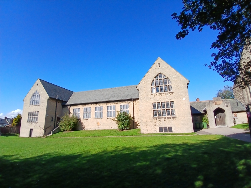
Parish hall to Church of St Andrew (qv). Dated 1928. Rubble magnesian limestone with ashlar and concrete dressings; Lakeland slate roof. One high storey, 6 windows with cross wings of 2 storeys, one window to front. Right link to church of one low storey, 2 windows. Linking corridor has projecting central porch with flat-pointed plain arch in crow-stepped gable. Irregular block jambs to flanking fixed lights under low eaves of deep roof. PRIESTMAN BUILDING 1928 in panel over door. Straight pointed arches to large mullion and transom 3-light hall windows and 5-light first floor windows under gables of wings. Lower windows of wings 5-light mullion and transom with wedge stone lintels. Similar lintels to 2-light transomed windows in returns of wings. Mullions, transoms and possibly arches of windows are reinforced concrete. Steeply pitched roof. Some rear windows blocked at time of survey. Included for group value.
Listing NGR: NZ4035659390
External links are from the relevant listing authority and, where applicable, Wikidata. Wikidata IDs may be related buildings as well as this specific building. If you want to add or update a link, you will need to do so by editing the Wikidata entry.


Other nearby listed buildings