Approximate Location Map
Large Map »
Latitude: 51.416 / 51°24'57"N
Longitude: -1.5198 / 1°31'11"W
OS Eastings: 433491
OS Northings: 168658
OS Grid: SU334686
Mapcode National: GBR 706.0LH
Mapcode Global: VHC1S.LNXW
Plus Code: 9C3WCF8J+93
Entry Name: 18, Church Croft
Listing Date: 8 June 1984
Grade: II
Source: Historic England
Source ID: 1210480
English Heritage Legacy ID: 395090
ID on this website: 101210480
Location: Hungerford, West Berkshire, RG17
County: West Berkshire
Civil Parish: Hungerford
Built-Up Area: Hungerford
Traditional County: Berkshire
Lieutenancy Area (Ceremonial County): Berkshire
Church of England Parish: Hungerford with Denford
Church of England Diocese: Oxford
Tagged with: Building
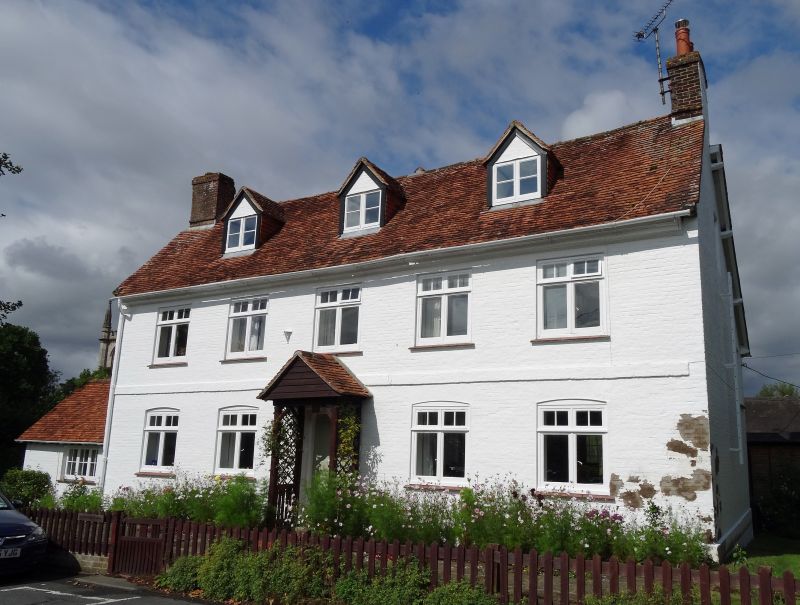
HUNGERFORD CHURCH CROFT (North Side)
SU 3368
18/23 No.18
II
House. Late C18 with C19 additions. Tiled roof with flanking chimneys.
Painted Brick. 2 storeys and attic. 3 gabled dormers symmetrically
placed. Moulded timber eaves cornice. 5 mullion and transom windows.
Band at first floor level. Central door under C20 gabled porch. Plinth.
Large C19 additions to rear.
Listing NGR: SU3349168658
External links are from the relevant listing authority and, where applicable, Wikidata. Wikidata IDs may be related buildings as well as this specific building. If you want to add or update a link, you will need to do so by editing the Wikidata entry.


Other nearby listed buildings
