Approximate Location Map
Large Map »
Latitude: 53.6525 / 53°39'8"N
Longitude: -1.785 / 1°47'6"W
OS Eastings: 414307
OS Northings: 417351
OS Grid: SE143173
Mapcode National: GBR HVZ6.BF
Mapcode Global: WHCB1.KG69
Plus Code: 9C5WM627+XX
Entry Name: 5-17, Clare Hill
Listing Date: 29 September 1978
Grade: II
Source: Historic England
Source ID: 1210523
English Heritage Legacy ID: 339701
ID on this website: 101210523
Location: Shearing Cross, Kirklees, West Yorkshire, HD1
County: Kirklees
Electoral Ward/Division: Greenhead
Parish: Non Civil Parish
Built-Up Area: Huddersfield
Traditional County: Yorkshire
Lieutenancy Area (Ceremonial County): West Yorkshire
Church of England Parish: St John the Evangelist Huddersfield
Church of England Diocese: Leeds
Tagged with: Building
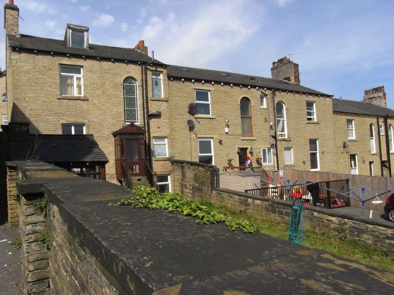
CLARE HILL
1.
5113 (South Side)
Nos 5 to 17 (odd)
SE 1417 28/369
II
2.
Mid C19. Ashlar. Pitched slate roof. 2 storeys. Moulded eaves cornice.
2 ranges of sashes each. One door each, with moulded panels and oblong fanlight
in moulded stone surround with cornice.
Listing NGR: SE1430717351
External links are from the relevant listing authority and, where applicable, Wikidata. Wikidata IDs may be related buildings as well as this specific building. If you want to add or update a link, you will need to do so by editing the Wikidata entry.


Other nearby listed buildings
