Latitude: 51.5126 / 51°30'45"N
Longitude: -0.1575 / 0°9'27"W
OS Eastings: 527952
OS Northings: 180905
OS Grid: TQ279809
Mapcode National: GBR 8C.TY
Mapcode Global: VHGQZ.772S
Plus Code: 9C3XGR7R+2X
Entry Name: 21, DUNRAVEN STREET W1 (See details for further address information)
Listing Date: 14 January 1970
Grade: II
Source: Historic England
Source ID: 1210976
English Heritage Legacy ID: 209554
ID on this website: 101210976
Location: Mayfair, Westminster, London, W1K
County: London
District: City of Westminster
Electoral Ward/Division: West End
Parish: Non Civil Parish
Built-Up Area: City of Westminster
Traditional County: Middlesex
Lieutenancy Area (Ceremonial County): Greater London
Church of England Parish: St George, Hanover Square
Church of England Diocese: London
Tagged with: Building
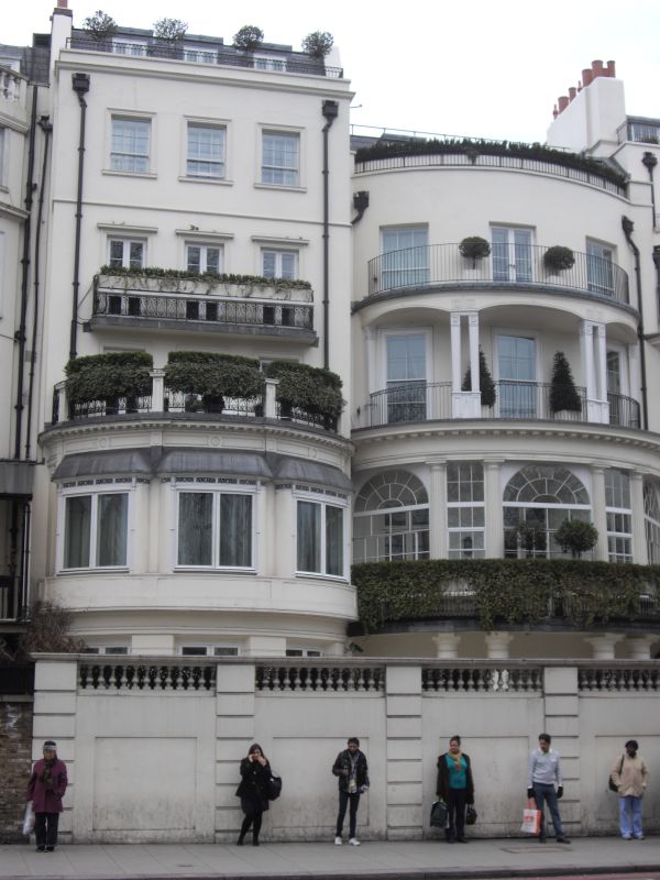
TQ 2780 NE CITY OF WESTMINSTER DUNRAVEN STREET Wl 67/12 14.1.70 No. 21 (Including No. 132 Park Lane) G.V. II Terrace house with west elevation to Park Lane. 1758 with heightening in c. 1834 and alterations of 1887. Stucco faced with rusticated ground floor. 5 storeys and basement.3 windows wide. Central late C19 Ionic columned porch. Architraved sash windows, no glazing bars, with pediments to upper floors except for top attic storey. Moulded strings between storeys, original main cornice over 2nd floor, cornice and blocking to attic. Park Lane elevation has glazed in columned and bowed 1st floor balcony with wrought iron balustrade and wrought iron balcony to 4th floor, architraved windows with cornices. Cast iron area railings. Survey of London; Vol. XL.
Listing NGR: TQ2795280905
External links are from the relevant listing authority and, where applicable, Wikidata. Wikidata IDs may be related buildings as well as this specific building. If you want to add or update a link, you will need to do so by editing the Wikidata entry.


Other nearby listed buildings