Latitude: 52.8011 / 52°48'3"N
Longitude: -2.1221 / 2°7'19"W
OS Eastings: 391861
OS Northings: 322618
OS Grid: SJ918226
Mapcode National: GBR 16X.B9V
Mapcode Global: WHBDT.CVPJ
Plus Code: 9C4VRV2H+C4
Entry Name: 1-13, Brunswick Terrace
Listing Date: 23 July 1980
Grade: II
Source: Historic England
Source ID: 1211117
English Heritage Legacy ID: 383936
ID on this website: 101211117
Location: Stafford, Staffordshire, ST16
County: Staffordshire
District: Stafford
Electoral Ward/Division: Rowley
Parish: Non Civil Parish
Built-Up Area: Stafford
Traditional County: Staffordshire
Lieutenancy Area (Ceremonial County): Staffordshire
Church of England Parish: Castle Church St Mary
Church of England Diocese: Lichfield
Tagged with: Building
STAFFORD
SJ9122 BRUNSWICK TERRACE 590-1/7/4 (South West side) 23/07/80 Nos.1-13 (Consecutive)
GV II
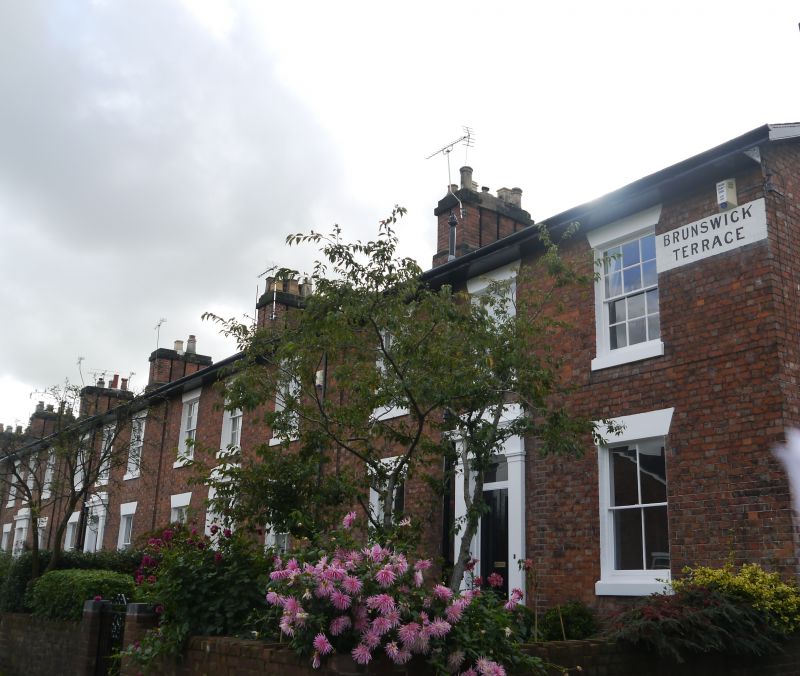
Terrace of 13 houses. c1850. Brick with stucco dressings; slate roof. Georgian style. 2 storeys; 39 bays each house symmetrical and double fronted Wide eaves. Each entrance in plaster doorcase with pilasters, frieze and cornice with gabled blocking course, overlight and door with 2 tall panels; No.4 has C20 panelled door. Windows have sills, and wedge lintels over 4-pane sashes to ground floor and 12-pane sashes to 1st floor; No.13 has later C19 two-storey canted bay window with enriched top frieze and three 2-pane sashes to ground floor, 4-pane sashes to 1st floor. End stacks and 12 cross-axial stacks. Some rear wings. Built as part of the development of the area following the opening of the railway, 1837. (Victoria County History of Staffordshire: Greenslade MW: A History of Stafford, taken from VCH: London: 1979-: 195).
Listing NGR: SJ9186122618
External links are from the relevant listing authority and, where applicable, Wikidata. Wikidata IDs may be related buildings as well as this specific building. If you want to add or update a link, you will need to do so by editing the Wikidata entry.


Other nearby listed buildings