Approximate Location Map
Large Map »
Latitude: 51.4863 / 51°29'10"N
Longitude: -0.6086 / 0°36'30"W
OS Eastings: 496707
OS Northings: 177293
OS Grid: SU967772
Mapcode National: GBR F8D.NYJ
Mapcode Global: VHFT8.DWMY
Plus Code: 9C3XF9PR+GH
Entry Name: 65-71, High Street
Listing Date: 14 May 1973
Grade: II
Source: Historic England
Source ID: 1211367
English Heritage Legacy ID: 395844
ID on this website: 101211367
Location: Eton, Windsor and Maidenhead, Berkshire, SL4
County: Windsor and Maidenhead
Civil Parish: Eton
Built-Up Area: Windsor
Traditional County: Buckinghamshire
Lieutenancy Area (Ceremonial County): Berkshire
Church of England Parish: Eton
Church of England Diocese: Oxford
Tagged with: Building
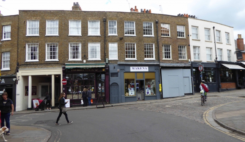
1. HIGH STREET
1909 (East side)
Nos 65 to 71 (consec)
SU 9677 SE 2/41
II GV
2.
Early C19 range on a slight curve. 3 storeys, 13 windows in all. Buff bricks.
Parapet. Glazing bars intact above ground floor. Modern and C19 shop fronts.
Glazing bars to shop window of No 69. Stucco facing to No 70.
Nos 65 to 71 (consec) form a group.
Listing NGR: SU9670777296
External links are from the relevant listing authority and, where applicable, Wikidata. Wikidata IDs may be related buildings as well as this specific building. If you want to add or update a link, you will need to do so by editing the Wikidata entry.


Other nearby listed buildings
