Approximate Location Map
Large Map »
Latitude: 50.3366 / 50°20'11"N
Longitude: -4.7984 / 4°47'54"W
OS Eastings: 200952
OS Northings: 52260
OS Grid: SX009522
Mapcode National: GBR ZX.9WD9
Mapcode Global: FRA 08V4.LG5
Plus Code: 9C2Q86P2+JJ
Entry Name: Old Bridge
Listing Date: 28 November 1950
Grade: II
Source: Historic England
Source ID: 1212078
English Heritage Legacy ID: 396588
ID on this website: 101212078
Location: St Austell, Cornwall, PL25
County: Cornwall
Civil Parish: St Austell
Built-Up Area: St Austell
Traditional County: Cornwall
Lieutenancy Area (Ceremonial County): Cornwall
Church of England Parish: St Austell
Church of England Diocese: Truro
Tagged with: Bridge
ST AUSTELL
1. LEDRAH ROAD
1584A
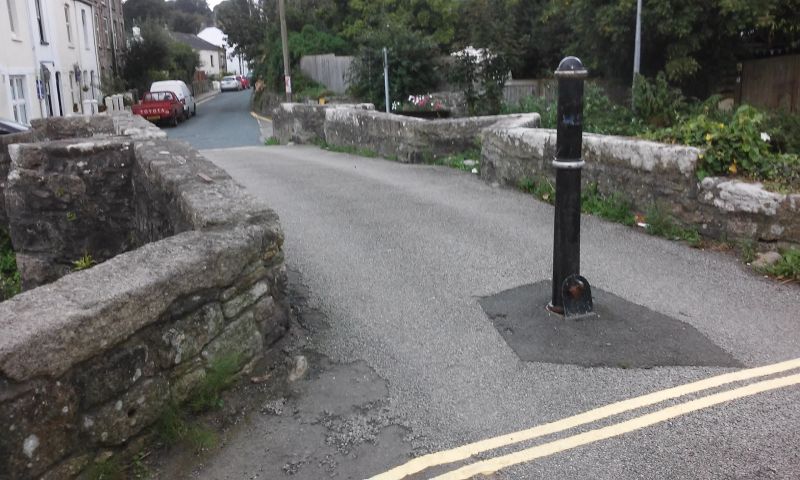
Old Bridge
SX 0052 1/499 28.11.50.
II
2.
C17, of uncoursed rubble. 3 small semi-circular arched waterways. 2
cutwaters. Refuges in parapets.
Listing NGR: SX0095252260
External links are from the relevant listing authority and, where applicable, Wikidata. Wikidata IDs may be related buildings as well as this specific building. If you want to add or update a link, you will need to do so by editing the Wikidata entry.


Other nearby listed buildings
