Latitude: 51.4505 / 51°27'1"N
Longitude: -1.1323 / 1°7'56"W
OS Eastings: 460389
OS Northings: 172744
OS Grid: SU603727
Mapcode National: GBR 92Z.2JH
Mapcode Global: VHCZ8.BS7Y
Plus Code: 9C3WFV29+53
Entry Name: The Village House
Listing Date: 14 April 1967
Grade: II
Source: Historic England
Source ID: 1212217
English Heritage Legacy ID: 396724
ID on this website: 101212217
Location: Bradfield, West Berkshire, RG7
County: West Berkshire
Civil Parish: Bradfield
Built-Up Area: Bradfield
Traditional County: Berkshire
Lieutenancy Area (Ceremonial County): Berkshire
Church of England Parish: Bradfield
Church of England Diocese: Oxford
Tagged with: House
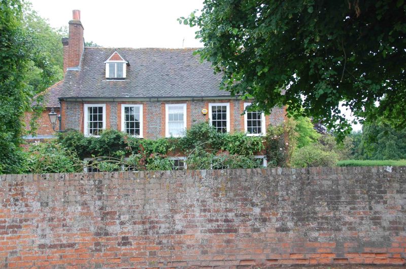
BRADFIELD ASHAMPSTEAD ROAD SU 6072 (north-east side) 12/3 The Village House 14.4.67 GV II House. Mid C18 with later additions to rear. Grey brick with red dressings, red gauged window heads and plinth. Moulded wooden eaves cornice to old tile roof with end stacks and 2 gabled dormers with 2- light leaded casements. 2 storeys, 5 bays, glazing bar sashes with exposed wooden boxes. Entrance to south-east.
Listing NGR: SU6038972744
External links are from the relevant listing authority and, where applicable, Wikidata. Wikidata IDs may be related buildings as well as this specific building. If you want to add or update a link, you will need to do so by editing the Wikidata entry.


Other nearby listed buildings