Latitude: 51.4492 / 51°26'56"N
Longitude: -1.1324 / 1°7'56"W
OS Eastings: 460383
OS Northings: 172598
OS Grid: SU603725
Mapcode National: GBR 92Z.2HV
Mapcode Global: VHCZ8.BT5Y
Plus Code: 9C3WCVX9+M2
Entry Name: Churchyard Wall and Tower Approximately 12 Metres to South and 25 Metres to East of Church of St Andrew
Listing Date: 29 November 1983
Grade: II
Source: Historic England
Source ID: 1212322
English Heritage Legacy ID: 396808
ID on this website: 101212322
Location: Bradfield, West Berkshire, RG7
County: West Berkshire
Civil Parish: Bradfield
Built-Up Area: Bradfield
Traditional County: Berkshire
Lieutenancy Area (Ceremonial County): Berkshire
Church of England Parish: Bradfield
Church of England Diocese: Oxford
Tagged with: Churchyard wall
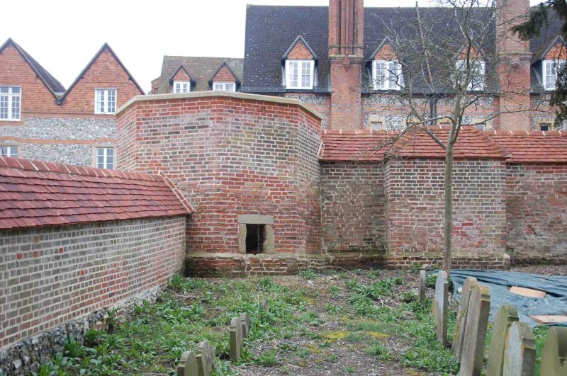
BRADFIELD BRADFIELD SU 6072 12/22 Churchyard Wall And Tower Approximately 12 Metres To South And 25 Metres To East Of Church Of St. Andrew GV II Wall and tower. Approximately 80 metres long and between 2 and 3 metres high. Red brick with some flint, stone and tile, some diapering, and rounded brick coping. Low octagonal brick tower to south-east with stone dressings, plinth, and vaulted brick roof. Small square headed cusped window to south-east and entrance to south-west. This wall and tower are two of the few remaining parts of Bradfield Place, on the site of which Bradfield College stands.V.C.H. (Berkshire), pp. 395-396; B.O.E, Berkshire; pp. 97-98; History of Bradfield College, Ed. Arthur F. Leach, Henry Frowde, 1900; Bradfield 1850-1978, John Blackie, St. Andrew's College.
Listing NGR: SU6038372597
External links are from the relevant listing authority and, where applicable, Wikidata. Wikidata IDs may be related buildings as well as this specific building. If you want to add or update a link, you will need to do so by editing the Wikidata entry.


Other nearby listed buildings