Latitude: 50.338 / 50°20'16"N
Longitude: -4.7926 / 4°47'33"W
OS Eastings: 201373
OS Northings: 52403
OS Grid: SX013524
Mapcode National: GBR ZX.9Y5B
Mapcode Global: FRA 08V4.NP6
Plus Code: 9C2Q86Q4+5X
Entry Name: 6-12, Victoria Place
Listing Date: 11 March 1974
Grade: II
Source: Historic England
Source ID: 1212219
English Heritage Legacy ID: 396602
ID on this website: 101212219
Location: St Austell, Cornwall, PL25
County: Cornwall
Civil Parish: St Austell
Built-Up Area: St Austell
Traditional County: Cornwall
Lieutenancy Area (Ceremonial County): Cornwall
Church of England Parish: St Austell
Church of England Diocese: Truro
Tagged with: Building
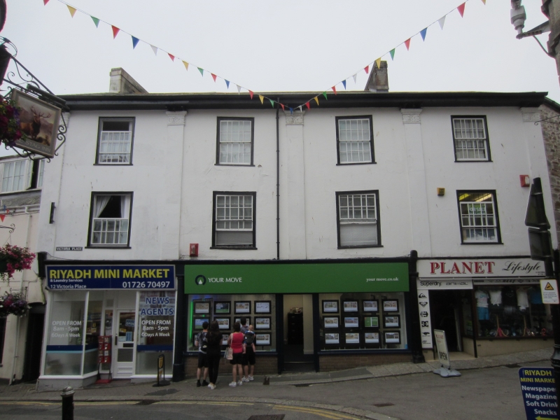
ST AUSTELL
1. VICTORIA PLACE
1584A
Nos 6 to 12 (even)
SX 0152 1/535
II
2.
Early C19 stucco. 3 storeys. 4 windows total, sashes in moulded cases
with glazing bars. C19 shop fronts with fluted Doric columns to entrances.
Moulded architraves. 4 pilasters, modified Corinthian. Overhanging
eaves. Slate roof.
Listing NGR: SX0137152401
External links are from the relevant listing authority and, where applicable, Wikidata. Wikidata IDs may be related buildings as well as this specific building. If you want to add or update a link, you will need to do so by editing the Wikidata entry.


Other nearby listed buildings