Latitude: 52.7487 / 52°44'55"N
Longitude: 0.4011 / 0°24'4"E
OS Eastings: 562162
OS Northings: 319486
OS Grid: TF621194
Mapcode National: GBR N3R.L84
Mapcode Global: WHJP7.458M
Plus Code: 9F42PCX2+FC
Entry Name: 14, Valingers Road
Listing Date: 7 June 1972
Grade: II
Source: Historic England
Source ID: 1212542
English Heritage Legacy ID: 384354
ID on this website: 101212542
Location: St James' End, King's Lynn and West Norfolk, Norfolk, PE30
County: Norfolk
District: King's Lynn and West Norfolk
Electoral Ward/Division: St Margarets with St Nicholas
Parish: Non Civil Parish
Built-Up Area: King's Lynn
Traditional County: Norfolk
Lieutenancy Area (Ceremonial County): Norfolk
Tagged with: Building
KING'S LYNN
TF6219SW VALINGERS ROAD 610-1/11/277 (North side) 07/06/72 No.14
GV II
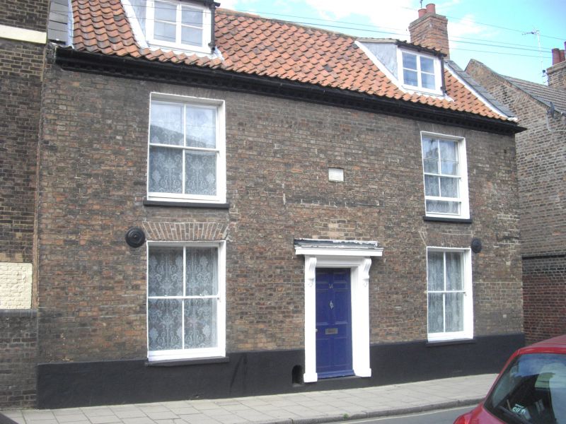
House. Dated 1807. Brown brick with pantiled roof. 2 storeys and dormer attic in 3 bays. Central panelled door with doorcase comprising consoles supporting a flat hood. One horned plate-glass sash window right and left, and 2 similar above them. Between first-floor windows a date plaque: DWA 1807. Timber modillion eaves cornice. Gabled roof with 2 sloping dormers. Gable heads have tumbling. Internal east gable-end stack.
Listing NGR: TF6216219485
External links are from the relevant listing authority and, where applicable, Wikidata. Wikidata IDs may be related buildings as well as this specific building. If you want to add or update a link, you will need to do so by editing the Wikidata entry.


Other nearby listed buildings