Latitude: 51.4434 / 51°26'36"N
Longitude: -1.1034 / 1°6'12"W
OS Eastings: 462406
OS Northings: 171986
OS Grid: SU624719
Mapcode National: GBR B4B.HTK
Mapcode Global: VHCZ8.TZJB
Plus Code: 9C3WCVVW+9J
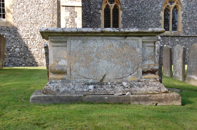
Entry Name: Webb Tomb Approximately 9 Metres to South East of Church of St Mark
Listing Date: 19 June 1984
Grade: II
Source: Historic England
Source ID: 1213169
English Heritage Legacy ID: 397734
ID on this website: 101213169
Location: St Mark's Church, Englefield, West Berkshire, RG7
County: West Berkshire
Civil Parish: Englefield
Traditional County: Berkshire
Lieutenancy Area (Ceremonial County): Berkshire
Church of England Parish: Englefield
Church of England Diocese: Oxford
Tagged with: Tomb
SU 67 SW ENGLEFIELD
4/35 Webb Tomb Approximately 9 Metres To South-east Of Church Of St. Mark
G.V. II
Chest tomb. 1748. Ashlar. Moulded base and top. Shaped corner balusters and oval panelled sides. Inscribed: Here lieth the body of Anthony Webb senior who departed this life November 18 1748 Aged 75 years.
Listing NGR: SU6240671986
External links are from the relevant listing authority and, where applicable, Wikidata. Wikidata IDs may be related buildings as well as this specific building. If you want to add or update a link, you will need to do so by editing the Wikidata entry.


Other nearby listed buildings