Approximate Location Map
Large Map »
Latitude: 51.4435 / 51°26'36"N
Longitude: -1.1037 / 1°6'13"W
OS Eastings: 462390
OS Northings: 171988
OS Grid: SU623719
Mapcode National: GBR B4B.HSG
Mapcode Global: VHCZ8.TZDB
Plus Code: 9C3WCVVW+9G
Entry Name: Welch Tomb Approximately 1 Metre to South East of Church of St Mark
Listing Date: 19 June 1984
Grade: II
Source: Historic England
Source ID: 1289195
English Heritage Legacy ID: 397732
ID on this website: 101289195
Location: St Mark's Church, Englefield, West Berkshire, RG7
County: West Berkshire
Civil Parish: Englefield
Traditional County: Berkshire
Lieutenancy Area (Ceremonial County): Berkshire
Church of England Parish: Englefield
Church of England Diocese: Oxford
Tagged with: Tomb
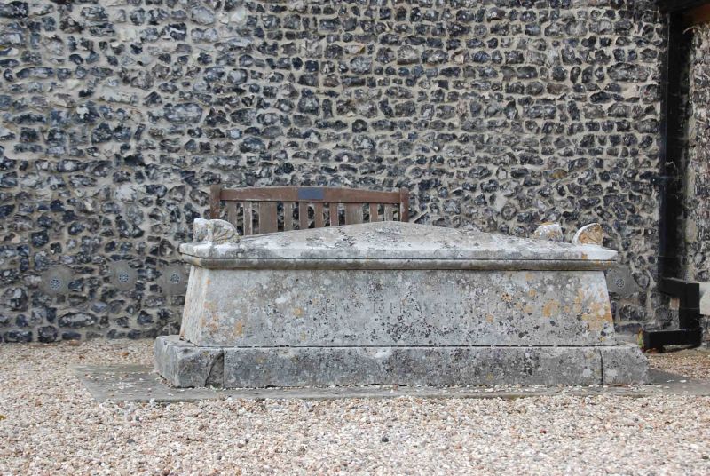
SU 67 SW ENGLEFIELD -
4/32 Welch Tomb Approximately
1 Metre To South-east
Of Church Of St. Mark
G.V. II
Chest tomb. 1810, in a neo-classical style. Ashlar. Rectangular base,
battered sides and top chamfered on all faces with corner acroteria.
Inscribed: Edward Welch.
Listing NGR: SU6239071988
External links are from the relevant listing authority and, where applicable, Wikidata. Wikidata IDs may be related buildings as well as this specific building. If you want to add or update a link, you will need to do so by editing the Wikidata entry.


Other nearby listed buildings
