Latitude: 51.5066 / 51°30'23"N
Longitude: -2.3337 / 2°20'1"W
OS Eastings: 376934
OS Northings: 178685
OS Grid: ST769786
Mapcode National: GBR 0NZ.JSP
Mapcode Global: VH961.HDMC
Plus Code: 9C3VGM48+JG
Entry Name: The Smithy
Listing Date: 15 August 1985
Grade: II
Source: Historic England
Source ID: 1214266
English Heritage Legacy ID: 398724
ID on this website: 101214266
Location: Tormarton, South Gloucestershire, GL9
County: South Gloucestershire
Civil Parish: Tormarton
Traditional County: Gloucestershire
Lieutenancy Area (Ceremonial County): Gloucestershire
Church of England Parish: Tormarton with West Littleton
Church of England Diocese: Bristol
Tagged with: Smithy
ST 77 NE TORMARTON C.P. THE STREET (south side)
6/289 The Smithy
- II
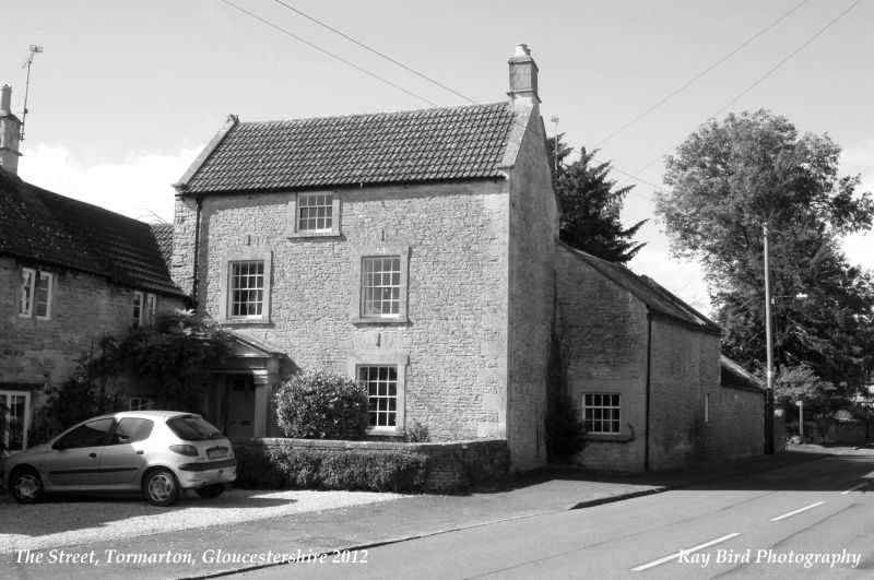
House. Early C19, possibly incorporating earlier building, with later alterations and additions. Limestone rubble with stone dressings and quoins, concrete double Roman tiled roof with raised coped verges and gable stack to right, finial to left, some stone tiles. 2½ storeys and 2 windows, all 16-pane sashes in plain surrounds with relieving arch and keystone set in relieving arch, portico to left with square columns and pediment, panelled and glass door, central 12-pane sash under eaves (not of C18 dimensions). Attached to left a 2-storey wing with garage doors to left and C20 3-light window, blocked door and 3-pane light, three 2-light casements with flat mullions under eaves; attached to left a single storey block with C20 garage door and stone tiled roof. Attached to right a 1½ storey wing with door and 2-light similar casement to inner side. Rear has ground floor sash, first floor sash with relieving arch, small central 2-light gabled dormer; C20 single storey extension to right with French windows and hipped roof. Interior: not inspected.
Listing NGR: ST7693478685
External links are from the relevant listing authority and, where applicable, Wikidata. Wikidata IDs may be related buildings as well as this specific building. If you want to add or update a link, you will need to do so by editing the Wikidata entry.


Other nearby listed buildings