Latitude: 54.0425 / 54°2'32"N
Longitude: -2.7841 / 2°47'2"W
OS Eastings: 348750
OS Northings: 461004
OS Grid: SD487610
Mapcode National: GBR 9P0P.1N
Mapcode Global: WH847.6NHB
Plus Code: 9C6V26R8+X9
Entry Name: Golgotha with Attached Garden Walls
Listing Date: 18 February 1970
Last Amended: 13 March 1995
Grade: II
Source: Historic England
Source ID: 1215039
English Heritage Legacy ID: 383359
ID on this website: 101215039
Location: Golgotha, Lancaster, Lancashire, LA1
County: Lancashire
District: Lancaster
Electoral Ward/Division: John O'Gaunt
Parish: Non Civil Parish
Built-Up Area: Lancaster
Traditional County: Lancashire
Lieutenancy Area (Ceremonial County): Lancashire
Church of England Parish: Lancaster Christ Church
Church of England Diocese: Blackburn
Tagged with: Cottage
LANCASTER
SD4861 WYRESDALE ROAD 1685-1/5/323 (West side) 18/02/70 No.2 Golgotha, with attached garden walls (Formerly Listed as: WYRESDALE ROAD No.2, Golgotha)
GV II
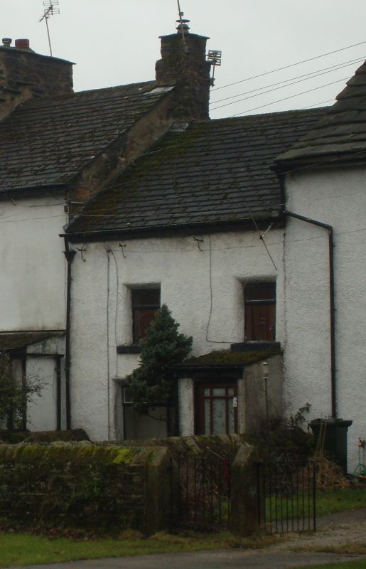
Cottage with attached garden walls. Early C18, altered C20. White painted roughcast, presumably on sandstone. Composition tile roof. Double-depth plan. 2 low storeys, 2 bays. Doorway to right now covered by modern porch, an enlarged window to left with deep chamfered surround, and 2 vertical-rectangular windows at 1st floor with similar surrounds, raised sills, and C20 casements. 3 slender iron gutter brackets below the level of the present gutter. Chimney at left end embraced by gable end of No.3 (qv). INTERIOR not inspected. SUBSIDIARY FEATURES: garden walls attached at each end and enclosing rectangular garden, of large coursed sandstone rubble, approx 1m high, with ridged coping.
Listing NGR: SD4875061004
External links are from the relevant listing authority and, where applicable, Wikidata. Wikidata IDs may be related buildings as well as this specific building. If you want to add or update a link, you will need to do so by editing the Wikidata entry.


Other nearby listed buildings