Latitude: 53.1465 / 53°8'47"N
Longitude: -1.1996 / 1°11'58"W
OS Eastings: 453632
OS Northings: 361335
OS Grid: SK536613
Mapcode National: GBR 8F5.PKC
Mapcode Global: WHDFZ.J5ZP
Plus Code: 9C5W4RW2+H5
Entry Name: 69A, West Gate
Listing Date: 17 March 1978
Grade: II
Source: Historic England
Source ID: 1215651
English Heritage Legacy ID: 391791
ID on this website: 101215651
Location: Mansfield, Nottinghamshire, NG18
County: Nottinghamshire
District: Mansfield
Electoral Ward/Division: Woodlands
Parish: Non Civil Parish
Built-Up Area: Mansfield
Traditional County: Nottinghamshire
Lieutenancy Area (Ceremonial County): Nottinghamshire
Church of England Parish: Mansfield St John with St Mary
Church of England Diocese: Southwell and Nottingham
Tagged with: Building
MANSFIELD
SK5361 WEST GATE 924-1/5/137 (South West side) 17/03/78 No.69A
GV II
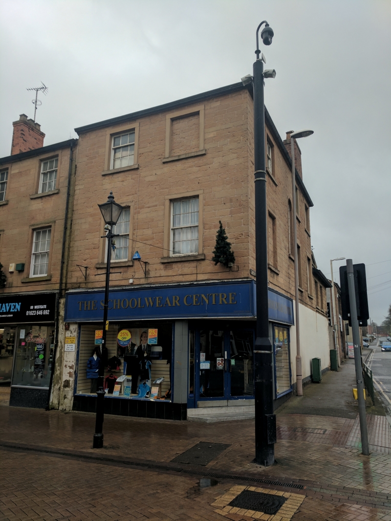
House, now shop. c1800, with mid C19 addition and late C20 alterations. Coursed squared stone with stone dressings and hipped and gabled slate roof and brick side wall stack. 3 and 2 storeys; 2 x 6 windows. West Gate front has 2 plain sashes and above, to left, a smaller 9-pane sash and to its right, a blocked window. All these windows have projecting surrounds. Ground floor has a mid C20 shop front, altered late C20, with glazed double corner door and sidelights, flanked by a single-pane window on each return. Right return, to St John Street, has to left a 3-storey block with central round-arched glazing bar stair window. On the first floor, a blocked window to left and two 12-pane sashes to right. Above, a smaller 9-pane sash to left, and 2 similar windows to right. All these windows have projecting surrounds. Blank rendered ground floor. 2-storey addition, to right, has 2 smaller 12-pane sashes and blank ground floor.
Listing NGR: SK5363261335
External links are from the relevant listing authority and, where applicable, Wikidata. Wikidata IDs may be related buildings as well as this specific building. If you want to add or update a link, you will need to do so by editing the Wikidata entry.


Other nearby listed buildings