Latitude: 50.7395 / 50°44'22"N
Longitude: -2.788 / 2°47'16"W
OS Eastings: 344493
OS Northings: 93616
OS Grid: SY444936
Mapcode National: GBR PN.DWGR
Mapcode Global: FRA 5714.3NL
Plus Code: 9C2VP6Q6+QR
Entry Name: 5 Table Tombs, 5-10 Metres South of the Parish Church
Listing Date: 10 January 1984
Grade: II
Source: Historic England
Source ID: 1216338
English Heritage Legacy ID: 401688
ID on this website: 101216338
Location: St John the Baptist's Church, Symondsbury, Dorset, DT6
County: Dorset
Civil Parish: Symondsbury
Traditional County: Dorset
Lieutenancy Area (Ceremonial County): Dorset
Church of England Parish: Symondsbury St John the Baptist
Church of England Diocese: Salisbury
Tagged with: Building
SY 49 SW SYMONDSBURY SYMONDSBURY VILLAGE
6/143 5 Table Tombs, 5 - 10
metres south of the
Parish Church
G.V. II
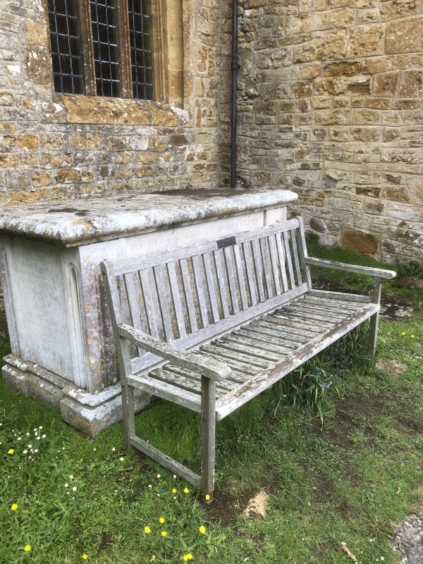
Table tombs in churchyard. (1) 5 yards south of nave. Stone with fluted
angle-pilasters and moulded table top, to Jacob Pitfield and wife dd. 1795,
1819. (2) Stone with rough fluted angle pilasters and concave-moulded top
to Charles Hitt, Surgeon, Mary and William Hitt, early C19. (3) Stone, with
"Indianized" angle pilasters with central roll, to Robert Colmer, d 1819,
Catherine and William. (4) Stone with incised angle pilasters and capitals,
and cambered stone top, to Thomas Hallett, 1878. (5) Early C19, overgrown
with ivy, 5 yards south of chancel.
Listing NGR: SY4449393616
External links are from the relevant listing authority and, where applicable, Wikidata. Wikidata IDs may be related buildings as well as this specific building. If you want to add or update a link, you will need to do so by editing the Wikidata entry.


Other nearby listed buildings