Latitude: 50.7392 / 50°44'20"N
Longitude: -2.7879 / 2°47'16"W
OS Eastings: 344499
OS Northings: 93579
OS Grid: SY444935
Mapcode National: GBR PN.DWJ5
Mapcode Global: FRA 5714.3PT
Plus Code: 9C2VP6Q6+MR
Entry Name: Church of England Primary School and Attached House
Listing Date: 10 January 1984
Grade: II
Source: Historic England
Source ID: 1287599
English Heritage Legacy ID: 401927
ID on this website: 101287599
Location: Symondsbury, Dorset, DT6
County: Dorset
Civil Parish: Symondsbury
Traditional County: Dorset
Lieutenancy Area (Ceremonial County): Dorset
Church of England Parish: Symondsbury St John the Baptist
Church of England Diocese: Salisbury
Tagged with: School building
SY 49 SW SYMONDSBURY SYMONDSBURY VILLAGE
6/152 C of E Primary School and attached house
G.V. II
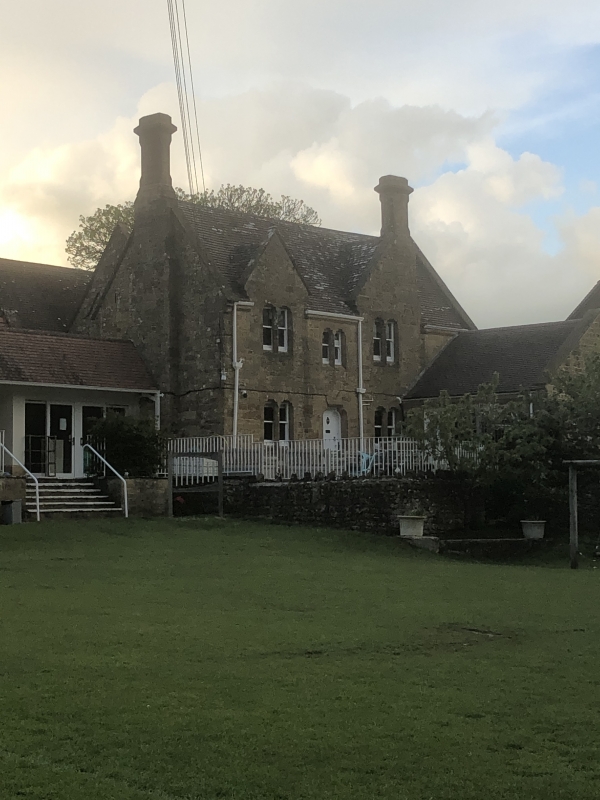
School, founded as Charity School. Tablets: "Raymond's Charity"; "Erected 1868" on north elevation. Lias stone walls. Plain tile roof with stone gable copings. 5 gables to north: small-large-small-large-small. One full storey. 7 windows, 2 light mullion-and-transom windows with cusped heads and an oculus over in a pointed frame. The 2 large gables have blocky projections with set-offs. 4-light transomed window in west gable with 3 oculi over. Rear block (former Schoolmaster's house) with asymmetrical gables, projecting stone stacks with set-offs and cornices. "RCHM, Dorset I", p 238 (4).
Listing NGR: SY4449893580
External links are from the relevant listing authority and, where applicable, Wikidata. Wikidata IDs may be related buildings as well as this specific building. If you want to add or update a link, you will need to do so by editing the Wikidata entry.


Other nearby listed buildings