Latitude: 51.1834 / 51°11'0"N
Longitude: 0.9397 / 0°56'22"E
OS Eastings: 605546
OS Northings: 146790
OS Grid: TR055467
Mapcode National: GBR SXQ.QDZ
Mapcode Global: VHKKH.7JM5
Plus Code: 9F325WMQ+8V
Entry Name: 36, High Street
Listing Date: 27 November 1957
Last Amended: 16 February 1989
Grade: II
Source: Historic England
Source ID: 1216923
English Heritage Legacy ID: 411636
ID on this website: 101216923
Location: Wye, Ashford, Kent, TN25
County: Kent
District: Ashford
Civil Parish: Wye with Hinxhill
Built-Up Area: Wye
Traditional County: Kent
Lieutenancy Area (Ceremonial County): Kent
Tagged with: Building
TR 0446 0546 WYE HIGH STREET (south side)
8/253 No. 36 (formerly 27.11.57 listed as Blue GV Shutters).
II
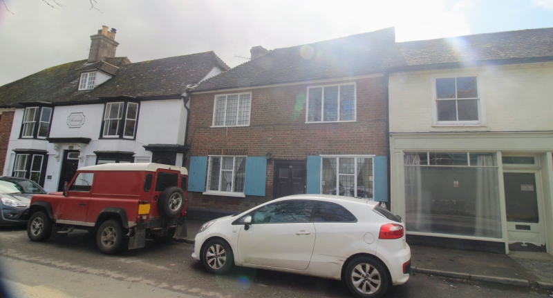
House. Circa 1700. Red brick with occasional blue headers in Flemish bond with plain tiled roof. Two storeys on plinth with roof hipped to left and stack to rear left. Two 3 light leaded wooden casements on each floor, with shutters on ground floor. Central door of 6 raised and fielded panels, the top 2 glazed.
Listing NGR: TR0554746788
External links are from the relevant listing authority and, where applicable, Wikidata. Wikidata IDs may be related buildings as well as this specific building. If you want to add or update a link, you will need to do so by editing the Wikidata entry.


Other nearby listed buildings