Approximate Location Map
Large Map »
Latitude: 50.7279 / 50°43'40"N
Longitude: -1.1654 / 1°9'55"W
OS Eastings: 459000
OS Northings: 92367
OS Grid: SZ590923
Mapcode National: GBR 9CN.65Y
Mapcode Global: FRA 87F5.5SF
Plus Code: 9C2WPRHM+5R
Entry Name: Wall to Street in Front of No 2
Listing Date: 18 May 1972
Grade: II
Source: Historic England
Source ID: 1216978
English Heritage Legacy ID: 411704
ID on this website: 101216978
Location: Ryde, Isle of Wight, PO33
County: Isle of Wight
Civil Parish: Ryde
Built-Up Area: Ryde
Traditional County: Hampshire
Lieutenancy Area (Ceremonial County): Isle of Wight
Church of England Parish: Ryde
Church of England Diocese: Portsmouth
Tagged with: Wall
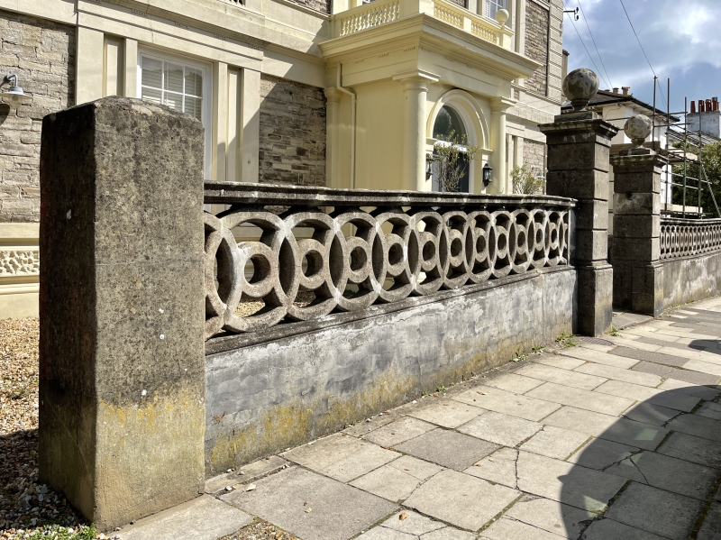
JOHN STREET
1.
1577
(North Side)
Wall to Street in
front of No 2
SZ 5892 1/232A
SZ 5992 1/232A
II
2.
Rendered wall with panels of interlinked circles articulated by tall
rusticated piers with plinths cornices and ball finials.
Listing NGR: SZ5900092367
External links are from the relevant listing authority and, where applicable, Wikidata. Wikidata IDs may be related buildings as well as this specific building. If you want to add or update a link, you will need to do so by editing the Wikidata entry.


Other nearby listed buildings
