Latitude: 51.8113 / 51°48'40"N
Longitude: -0.0331 / 0°1'59"W
OS Eastings: 535686
OS Northings: 214343
OS Grid: TL356143
Mapcode National: GBR KBL.JF7
Mapcode Global: VHGPH.CQTV
Plus Code: 9C3XRX68+GP
Entry Name: 81, High Street
Listing Date: 14 March 1974
Grade: II
Source: Historic England
Source ID: 1217435
English Heritage Legacy ID: 412361
ID on this website: 101217435
Location: Ware, East Hertfordshire, SG12
County: Hertfordshire
District: East Hertfordshire
Civil Parish: Ware
Built-Up Area: Ware
Traditional County: Hertfordshire
Lieutenancy Area (Ceremonial County): Hertfordshire
Church of England Parish: Ware
Church of England Diocese: St.Albans
Tagged with: Building
WARE TOWN
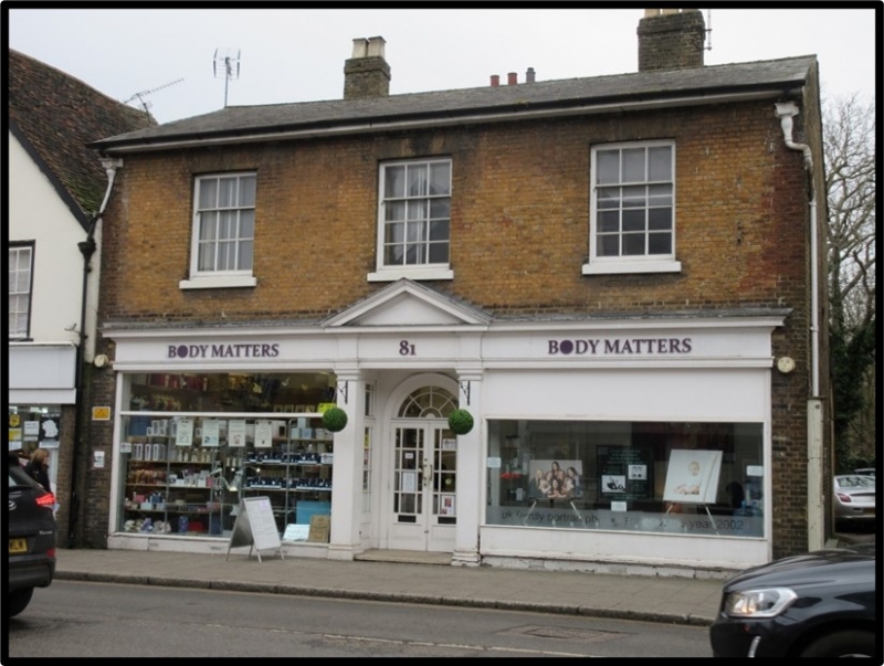
TL3514SE HIGH STREET 829-1/9/125 (South side) 14/03/74 No.81
GV II
House, now shops with flat above. 1833, dated on rainwater head. Built for Ware Gas Light and Coke Company, ground floor rebuilt 1954. Yellow stock brick, Welsh slated roof, with 2 brick chimneys with square terracotta pots. 2 storeys. 3 first floor sash windows with glazing bars in reveals under flat arches. Ground floor has Neo-Georgian shopfront with entablatures, central pediment above Doric pilasters enclosing recessed entrance, with twin leaded glazed doors under semicircular fanlight with radiating glazing bars and moulded archivolt. Site of The Checker Inn, first recorded 1509. The C19 rebuilding incorporates some reused timber, as indicated by a moulded beam, used as a purlin in the roof of the rear outshoot. (Perman D: Ware UD. List of buildings of special arch or historic interest: 1993-: 35).
Listing NGR: TL3568414328
External links are from the relevant listing authority and, where applicable, Wikidata. Wikidata IDs may be related buildings as well as this specific building. If you want to add or update a link, you will need to do so by editing the Wikidata entry.


Other nearby listed buildings