Latitude: 53.3895 / 53°23'22"N
Longitude: -3.0112 / 3°0'40"W
OS Eastings: 332844
OS Northings: 388554
OS Grid: SJ328885
Mapcode National: GBR 7YD7.WN
Mapcode Global: WH87D.Q28B
Plus Code: 9C5R9XQQ+RG
Entry Name: Remains of Church of St Mary
Listing Date: 29 July 1950
Last Amended: 10 August 1992
Grade: II
Source: Historic England
Source ID: 1218757
English Heritage Legacy ID: 389302
Also known as: St Mary's Church, Birkenhead Priory
ID on this website: 101218757
Location: Birkenhead, Wirral, Merseyside, CH41
County: Wirral
Electoral Ward/Division: Birkenhead and Tranmere
Parish: Non Civil Parish
Built-Up Area: Birkenhead
Traditional County: Cheshire
Lieutenancy Area (Ceremonial County): Merseyside
Church of England Parish: Birkenhead Christ the King
Church of England Diocese: Chester
Tagged with: Former church Church building
BIRKENHEAD
SJ3288NE PRIORY STREET 789-1/14/141 (East side) 29/07/50 Remains of Church of St Mary (Formerly Listed as: CHURCH STREET Church of St Mary)
GV II
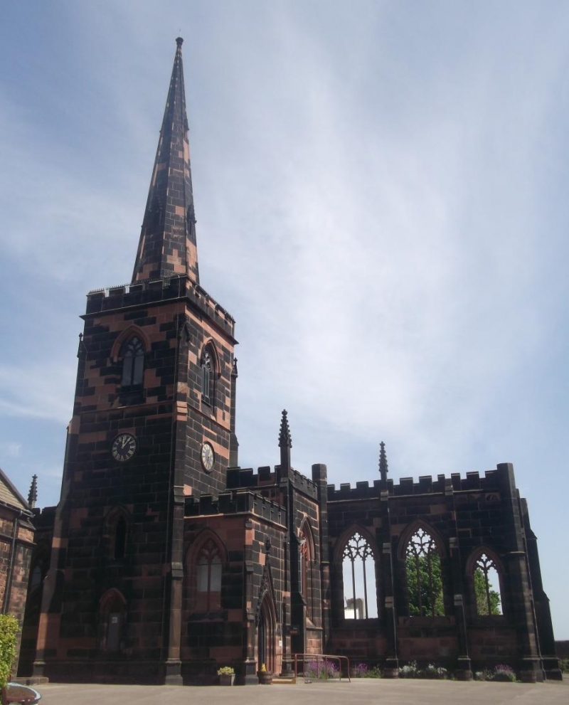
Remains of Church of St Mary. 1821. By Thomas Rickman, partly demolished in 1975. Finely coursed and squared sandstone facing over brick. Originally the church consisted of a W tower, 5-bay aiseless nave, polygonal sanctuary and very large transepts (added 1832-5); of this the W tower and part of the nave and transepts survive. West tower with two flanking porches, and a length of south wall are all that survive. Two stage tower with foiled lancet windows in first stage with clock over, and moulded arched doors in crocketted expressed gabled hoodmould in south porch. Plain moulded doorway in north porch. 2-light belfry openings in second stage. Embattled parapet and recessed spire with lucarnes. 3 bays of south wall, divided by buttresses with pinnacles, and 2- and 3-light windows with cast-iron tracery. Embattled parapet. The church was built to serve the expanding new town of Birkenhead, but became redundant in 1975, when the rest of the structure was demolished. (The Buildings of England: Pevsner N and Hubbard E: Cheshire: Harmondsworth: 1971-).
Listing NGR: SJ3284488554
External links are from the relevant listing authority and, where applicable, Wikidata. Wikidata IDs may be related buildings as well as this specific building. If you want to add or update a link, you will need to do so by editing the Wikidata entry.


Other nearby listed buildings