Latitude: 51.453 / 51°27'10"N
Longitude: -2.5894 / 2°35'21"W
OS Eastings: 359141
OS Northings: 172836
OS Grid: ST591728
Mapcode National: GBR C9K.BZ
Mapcode Global: VH88N.2QFZ
Plus Code: 9C3VFC36+66
Entry Name: 14, Victoria Street
Listing Date: 23 June 1987
Grade: II
Source: Historic England
Source ID: 1218983
English Heritage Legacy ID: 380780
ID on this website: 101218983
Location: Box Makers Yard, Bristol, BS1
County: City of Bristol
Electoral Ward/Division: Central
Parish: Non Civil Parish
Built-Up Area: Bristol
Traditional County: Somerset
Lieutenancy Area (Ceremonial County): Bristol
Church of England Parish: St Mary Redcliffe with Temple, Bristol and St John the Baptist, Bedminster
Church of England Diocese: Bristol
Tagged with: Building
BRISTOL
ST5972 VICTORIA STREET 901-1/42/323 (North East side) 23/06/87 No.14
GV II
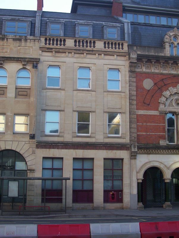
Shop. c1875. Limestone ashlar and render, brick stack and slate mansard roof. Double-depth plan. 3 storeys; 3-window range. Rendered ground floor and C20 shop front; upper windows set in recessed bays, plate-glass sashes separated by moulded panels, cornice with worn brackets and a balustrade with turned balusters, before 2 small dormers. INTERIOR not inspected. Part of a group of Victorian commercial buildings built when Victoria Street was cut in 1872.
Listing NGR: ST5912972847
External links are from the relevant listing authority and, where applicable, Wikidata. Wikidata IDs may be related buildings as well as this specific building. If you want to add or update a link, you will need to do so by editing the Wikidata entry.


Other nearby listed buildings