Latitude: 53.7449 / 53°44'41"N
Longitude: -2.9783 / 2°58'41"W
OS Eastings: 335580
OS Northings: 428062
OS Grid: SD355280
Mapcode National: GBR 7TN4.08
Mapcode Global: WH85P.741D
Plus Code: 9C5VP2VC+XM
Entry Name: Dovecote to North West of Lytham Hall (In Woods Behind Stables)
Listing Date: 13 January 1971
Grade: II*
Source: Historic England
Source ID: 1219120
English Heritage Legacy ID: 385288
ID on this website: 101219120
Location: Ansdell, Fylde, Lancashire, FY8
County: Lancashire
District: Fylde
Electoral Ward/Division: Clifton
Parish: Lytham
Built-Up Area: Lytham St Anne's
Traditional County: Lancashire
Lieutenancy Area (Ceremonial County): Lancashire
Church of England Parish: Lytham St Cuthbert
Church of England Diocese: Blackburn
Tagged with: Dovecote
LYTHAM ST ANNES
SD32NE LYTHAM PARK, Lytham 621-1/3/69 Dovecote to NW of Lytham Hall (in 13/01/71 woods behind stables)
II*
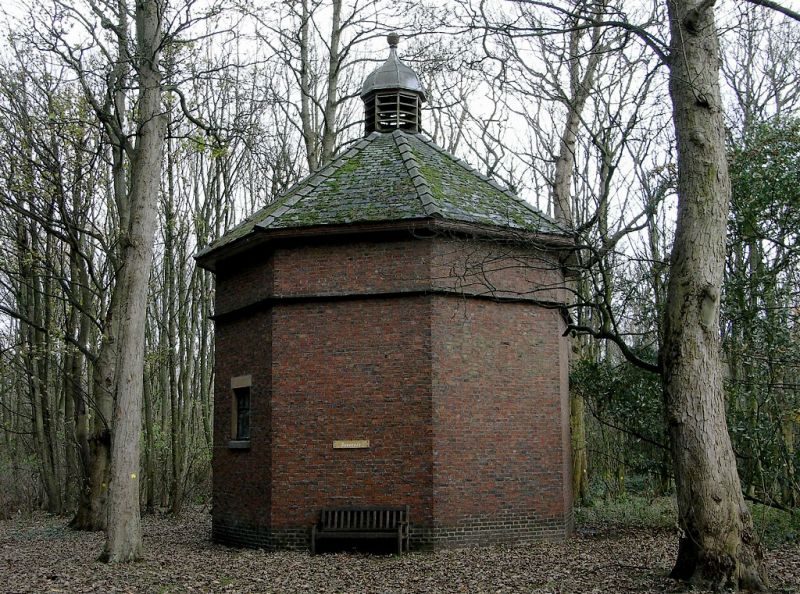
Dovecote. Later C18. Red brick in Flemish bond, with slate roof and lead-capped lantern. Octagonal plan. High single storey; with a stone ledge carried round approx. 1 metre below the eaves, a segmental-headed doorway in the east side, a very small 6-pane window above the ledge in the same side, and rectangular windows in the west and north-east sides. Octagonal roof with oversailing eaves and a louvred octagonal lantern with an ogival cap terminating in a ball finial. The INTERIOR is lined with 850 nest boxes, and furnished with a very fine single-sided timber potence so perfectly balanced that it can be pushed round with one finger.
Listing NGR: SD3558028062
External links are from the relevant listing authority and, where applicable, Wikidata. Wikidata IDs may be related buildings as well as this specific building. If you want to add or update a link, you will need to do so by editing the Wikidata entry.


Other nearby listed buildings