Latitude: 53.7437 / 53°44'37"N
Longitude: -2.9772 / 2°58'37"W
OS Eastings: 335648
OS Northings: 427922
OS Grid: SD356279
Mapcode National: GBR 7TN4.7Q
Mapcode Global: WH85P.75JC
Plus Code: 9C5VP2VF+F4
Entry Name: Screen Wall attached to South West of rear wing of Lytham Hall and attached cottage and privy
Listing Date: 13 January 1971
Last Amended: 15 February 1993
Grade: II
Source: Historic England
Source ID: 1297649
English Heritage Legacy ID: 385291
ID on this website: 101297649
Location: Fylde, Lancashire, FY8
County: Lancashire
District: Fylde
Electoral Ward/Division: Clifton
Parish: Lytham
Built-Up Area: Lytham St Anne's
Traditional County: Lancashire
Lieutenancy Area (Ceremonial County): Lancashire
Church of England Parish: Lytham St Cuthbert
Church of England Diocese: Blackburn
Tagged with: Wall
This list entry was subject to a Minor Amendment on 16 December 2024 to amend details in the description and to reformat the text to current standards
SD32NE
621-1/3/72
LYTHAM ST ANNES
Lytham
LYTHAM PARK,
Screen Wall attached to South West of rear wing of Lytham Hall and attached cottage and privy
(Formerly Listed as: LYTHAM Screen Wall at Lytham Hall)
13/01/71
GV
II
Also known as: Monks' Walk.
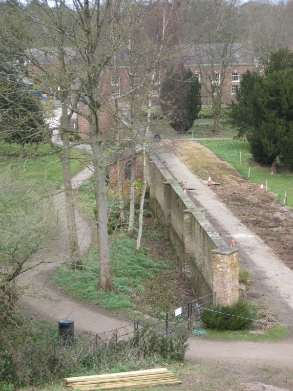
Screen wall, perhaps formerly one side of a walled garden, incorporating a cottage now known as the Old School Room, and with an attached privy.
In two builds, probably C17 and C18; altered. Mostly hand-made red brick, the northern half (which appears to be the older) in 4+1 English garden wall bond and the southern half (including the cottage) with 3 quarter-bonded stretcher courses to one course in which stretchers alternate with pairs of headers.
The wall is approx. 110m long, running straight on a line slightly east of south, and approx. 4m high, with a plinth approx. 1m high; the portion north of the cottage has large stepped half-height buttresses on the east side, and a saw-tooth band close to the top (and some modern common brick above); the rest has triangular buttress-pilasters.
The centre portion forms the rear wall of a mid-to-late C18 cottage on the west side, which has a single-depth two-unit plan and a low two-storey two-window facade, with a segmental-headed doorway in the centre and segmental-headed casement windows of three lights to the left and two lights to the right; a ridge chimney; and a rear doorway through the wall.
Approx. 30m south of the cottage and on the same side is an early C19 lean-to privy which has a two-centred arched window in each side, both sashed with intersecting glazing bars (but lacking the glass and one damaged), a six-panel door in the east wall, and a wooden two-hole privy seat inside.
Listing NGR: SD3566127884
External links are from the relevant listing authority and, where applicable, Wikidata. Wikidata IDs may be related buildings as well as this specific building. If you want to add or update a link, you will need to do so by editing the Wikidata entry.


Other nearby listed buildings