Approximate Location Map
Large Map »
Latitude: 50.1168 / 50°7'0"N
Longitude: -5.534 / 5°32'2"W
OS Eastings: 147456
OS Northings: 30059
OS Grid: SW474300
Mapcode National: GBR DXQC.MX2
Mapcode Global: VH12Z.1B7B
Plus Code: 9C2P4F88+P9
Entry Name: 23, Chapel Street
Listing Date: 7 February 1974
Grade: II
Source: Historic England
Source ID: 1220504
English Heritage Legacy ID: 69450
ID on this website: 101220504
Location: Penzance, Cornwall, TR18
County: Cornwall
Civil Parish: Penzance
Built-Up Area: Penzance
Traditional County: Cornwall
Lieutenancy Area (Ceremonial County): Cornwall
Church of England Parish: Penzance St Mary the Virgin with St Paul
Church of England Diocese: Truro
Tagged with: Building
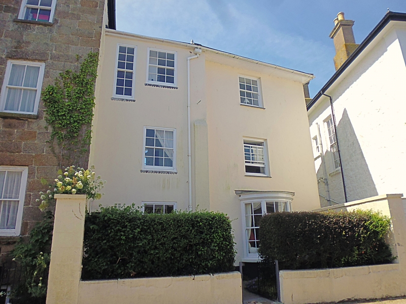
1.
1498 PENZANCE
CHAPEL STREET
(South West Side)
No 23
SW 4730 5/25A
II GV
2.
C18 or early C19. Cement rendered. Slate hipped roof. 3 storeys. 3 windows,
irregular fenestration. Sashes with glazing bars. Left hand slightly projects.
Ground floor right splayed bay window. Included for group value.
Nos 19 to 28 (consec) form a group.
Listing NGR: SW4746530055
External links are from the relevant listing authority and, where applicable, Wikidata. Wikidata IDs may be related buildings as well as this specific building. If you want to add or update a link, you will need to do so by editing the Wikidata entry.


Other nearby listed buildings
