Latitude: 50.1167 / 50°7'0"N
Longitude: -5.5336 / 5°32'0"W
OS Eastings: 147489
OS Northings: 30047
OS Grid: SW474300
Mapcode National: GBR DXQC.N40
Mapcode Global: VH12Z.1BGD
Plus Code: 9C2P4F88+MH
Entry Name: 25-28, Chapel Street
Listing Date: 8 April 1970
Grade: II
Source: Historic England
Source ID: 1327890
English Heritage Legacy ID: 69452
ID on this website: 101327890
Location: Penzance, Cornwall, TR18
County: Cornwall
Civil Parish: Penzance
Built-Up Area: Penzance
Traditional County: Cornwall
Lieutenancy Area (Ceremonial County): Cornwall
Church of England Parish: Penzance St Mary the Virgin with St Paul
Church of England Diocese: Truro
Tagged with: Building
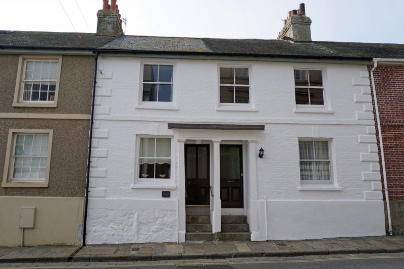
1.
1498 PENZANCE
CHAPEL STREET
(South West Side)
Nos 25 to 28 (consec)
SW 4730 5/27 8.4.70.
II GV
2.
C18/19 row of small houses. Painted brick, granite plinth, one string course,
quoins. Slate roof. Each 2 storeys, 3 windows, sashes without glazing bars.
Flat pilastered doorcases with cornices. No 28 now roughcast.
Nos 19 to 28 (consec) form a group.
Listing NGR: SW4748930047
External links are from the relevant listing authority and, where applicable, Wikidata. Wikidata IDs may be related buildings as well as this specific building. If you want to add or update a link, you will need to do so by editing the Wikidata entry.


Other nearby listed buildings