Approximate Location Map
Large Map »
Latitude: 50.8094 / 50°48'33"N
Longitude: -2.7364 / 2°44'10"W
OS Eastings: 348212
OS Northings: 101347
OS Grid: ST482013
Mapcode National: GBR MJ.YBK7
Mapcode Global: FRA 564Y.RRH
Plus Code: 9C2VR757+PF
Entry Name: 20, North Street
Listing Date: 22 December 1983
Grade: II
Source: Historic England
Source ID: 1220917
English Heritage Legacy ID: 394601
ID on this website: 101220917
Location: Beaminster, Dorset, DT8
County: Dorset
Civil Parish: Beaminster
Built-Up Area: Beaminster
Traditional County: Dorset
Lieutenancy Area (Ceremonial County): Dorset
Church of England Parish: Beaminster St Mary of the Annunciation
Church of England Diocese: Salisbury
Tagged with: Building
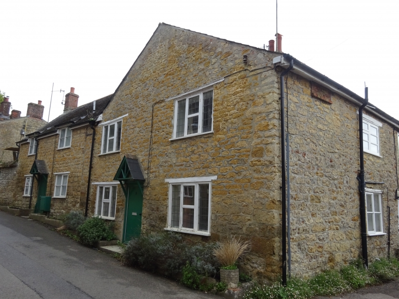
BEAMINSTER NORTH STREET
ST 4701/4801
(SOUTH SIDE)
7/118 No 20
GV II
Attached Cottage, C19. Lias rubble walls. Asbestos slate roof with
gable-end to street. 2 storeys. 2 windows. 3-light casements with
wooden frames and small lead lights. Wooden lintels over. Front door
at centre, plank with small gabled canopy over.
Listing NGR: ST4821201349
External links are from the relevant listing authority and, where applicable, Wikidata. Wikidata IDs may be related buildings as well as this specific building. If you want to add or update a link, you will need to do so by editing the Wikidata entry.


Other nearby listed buildings
