Latitude: 50.8094 / 50°48'33"N
Longitude: -2.7371 / 2°44'13"W
OS Eastings: 348159
OS Northings: 101351
OS Grid: ST481013
Mapcode National: GBR MJ.YBCQ
Mapcode Global: FRA 564Y.RGQ
Plus Code: 9C2VR757+Q5
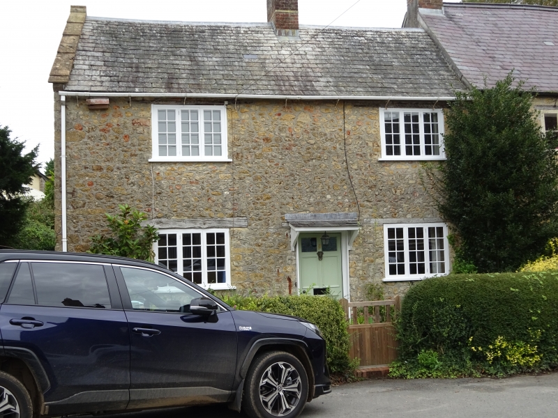
Entry Name: 17, North Street
Listing Date: 12 June 1953
Grade: II
Source: Historic England
Source ID: 1220885
English Heritage Legacy ID: 394525
ID on this website: 101220885
Location: Beaminster, Dorset, DT8
County: Dorset
Civil Parish: Beaminster
Built-Up Area: Beaminster
Traditional County: Dorset
Lieutenancy Area (Ceremonial County): Dorset
Church of England Parish: Beaminster St Mary of the Annunciation
Church of England Diocese: Salisbury
Tagged with: Building
BEAMINSTER NORTH STREET
ST 4701/4801
12-6-53 (NORTH SIDE)
7/105 No 17
GV II
Attached House. c. C18. Random rubble-stone walls. Slate roof with
stone gable-coping at left hand with roll-moulded apex. Brick stack on
ridge at centre. 2 storeys. 2 windows, 3-light wooden casements and
glazing-bars with wooden lintels over. Front door at centre wood planks
with 1 top light, C20.
Listing NGR: ST4815701354
External links are from the relevant listing authority and, where applicable, Wikidata. Wikidata IDs may be related buildings as well as this specific building. If you want to add or update a link, you will need to do so by editing the Wikidata entry.


Other nearby listed buildings