Approximate Location Map
Large Map »
Latitude: 53.5874 / 53°35'14"N
Longitude: -1.9514 / 1°57'4"W
OS Eastings: 403316
OS Northings: 410092
OS Grid: SE033100
Mapcode National: GBR GVTY.BR
Mapcode Global: WHB97.0314
Plus Code: 9C5WH2PX+XF
Entry Name: Guide Post
Listing Date: 11 July 1985
Grade: II
Source: Historic England
Source ID: 1221566
English Heritage Legacy ID: 413150
ID on this website: 101221566
Location: Kirklees, West Yorkshire, HD7
County: Kirklees
Electoral Ward/Division: Colne Valley
Parish: Non Civil Parish
Traditional County: Yorkshire
Lieutenancy Area (Ceremonial County): West Yorkshire
Church of England Parish: Marsden St Bartholomew
Church of England Diocese: Leeds
Tagged with: Milestone Fingerpost
SE 034101 MOUNT ROAD (OFF)
Standedge
4/328 Marsden
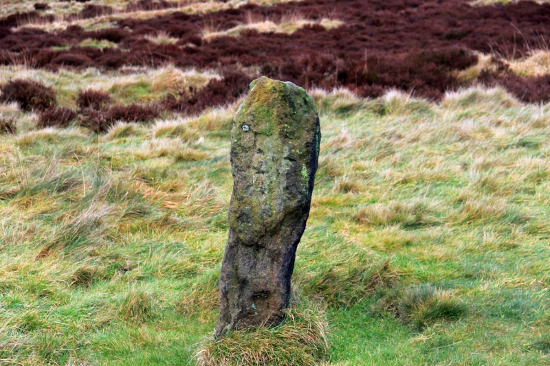
- Guide Post
- II
Probably C17. Guide post near junction of early trans-Pennine routes from Colne
Valley. Post has definite markings but these cannot be read. A similar post
at Marsden Manor House, close by, is now in use as a gate post and is dated 1674.
Listing NGR: SE0331610092
External links are from the relevant listing authority and, where applicable, Wikidata. Wikidata IDs may be related buildings as well as this specific building. If you want to add or update a link, you will need to do so by editing the Wikidata entry.


Other nearby listed buildings
