Approximate Location Map
Large Map »
Latitude: 51.4047 / 51°24'16"N
Longitude: 0.1932 / 0°11'35"E
OS Eastings: 552648
OS Northings: 169581
OS Grid: TQ526695
Mapcode National: GBR SX.CDG
Mapcode Global: VHHP0.9YJJ
Plus Code: 9F32C53V+V7
Entry Name: Hillbrow
Listing Date: 22 October 1982
Grade: II
Source: Historic England
Source ID: 1223066
English Heritage Legacy ID: 416886
ID on this website: 101223066
Location: Swanley Village, Sevenoaks, Kent, BR8
County: Kent
District: Sevenoaks
Civil Parish: Swanley
Built-Up Area: Swanley
Traditional County: Kent
Lieutenancy Area (Ceremonial County): Kent
Church of England Parish: Swanley St Paul
Church of England Diocese: Rochester
Tagged with: Building
TQ 5269 8/224
5280
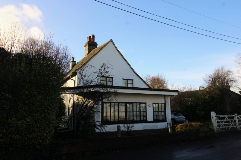
SWANLEY,
SWANLEY VILLAGE ROAD (south side),
Hillbrow
(Formerly listed as A E Simpson (Butcher) and house adjoining)
II GV
Late C15 to early C16 timber-framed building now refronted. Two storeys stuccoed,
the ground floor under built in brick. Tiled roof. One modern casement window.
Later butcher's shop extension to ground floor.
Listing NGR: TQ5264869581
External links are from the relevant listing authority and, where applicable, Wikidata. Wikidata IDs may be related buildings as well as this specific building. If you want to add or update a link, you will need to do so by editing the Wikidata entry.


Other nearby listed buildings
