Latitude: 51.2758 / 51°16'32"N
Longitude: 0.5243 / 0°31'27"E
OS Eastings: 576163
OS Northings: 155986
OS Grid: TQ761559
Mapcode National: GBR PR1.TM1
Mapcode Global: VHJMF.16JB
Plus Code: 9F327GGF+8P
Entry Name: The Salvation Army Hall
Listing Date: 2 August 1974
Grade: II
Source: Historic England
Source ID: 1225501
English Heritage Legacy ID: 421897
ID on this website: 101225501
Location: Maidstone, Kent, ME14
County: Kent
District: Maidstone
Electoral Ward/Division: High Street
Parish: Non Civil Parish
Built-Up Area: Maidstone
Traditional County: Kent
Lieutenancy Area (Ceremonial County): Kent
Tagged with: Architectural structure
UNION STiEET 1. 5278 (South Side) The Salvation Army Hall TQ 7655 NW 2/361 II
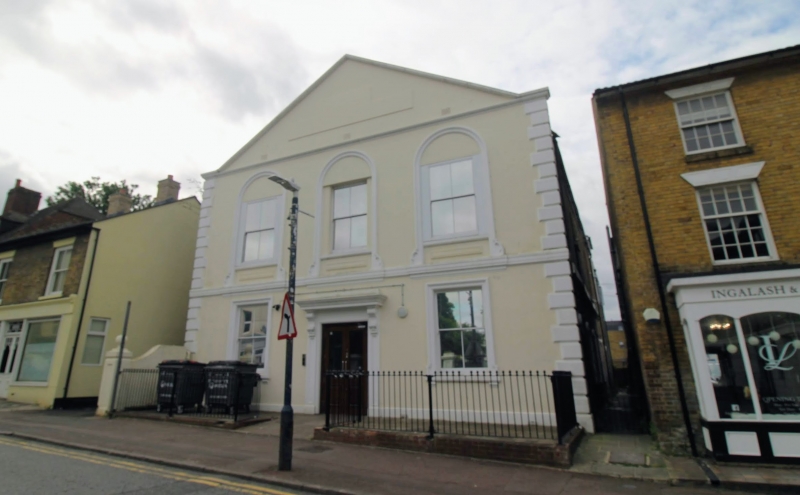
2. This was formerly a Baptist Church. Mid C19, 2 storeys colourwashed. Pediment- shaped gable. Long and short quoins. Stringcourse. 3 sashes on the 1st floor with verticals only, set in round-headed arcading with panels beneath. Central doorcase with cornice and console brackets. 2 sashes on the ground floor with verticals only and moulded architraves.
Listing NGR: TQ7620556030
External links are from the relevant listing authority and, where applicable, Wikidata. Wikidata IDs may be related buildings as well as this specific building. If you want to add or update a link, you will need to do so by editing the Wikidata entry.


Other nearby listed buildings