Approximate Location Map
Large Map »
Latitude: 51.2756 / 51°16'32"N
Longitude: 0.5187 / 0°31'7"E
OS Eastings: 575778
OS Northings: 155954
OS Grid: TQ757559
Mapcode National: GBR PR0.ZYF
Mapcode Global: VHJMD.Y63G
Plus Code: 9F327GG9+6F
Entry Name: 9, Waterside
Listing Date: 30 July 1951
Grade: II
Source: Historic England
Source ID: 1225555
English Heritage Legacy ID: 421965
ID on this website: 101225555
Location: Maidstone, Kent, ME14
County: Kent
District: Maidstone
Electoral Ward/Division: High Street
Parish: Non Civil Parish
Built-Up Area: Maidstone
Traditional County: Kent
Lieutenancy Area (Ceremonial County): Kent
Tagged with: Building
This list entry was subject to a Minor Amendment on 14/01/2020
TQ 7555 NE
1/109
WATERSIDE
No 9
30.7.51
GV
II
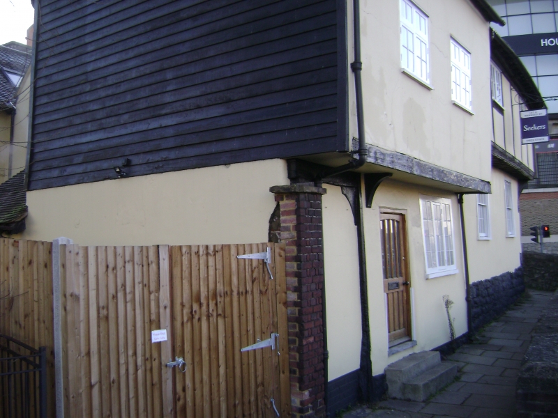
Timber-framed cottage with plastered front and first floor jettied on a bressumer and bracket. Two storeys. Two casement windows. Tiled roof.
Group value with Nos 60, 62, and 62A St Faith's Street.
Listing NGR: TQ7577855954
External links are from the relevant listing authority and, where applicable, Wikidata. Wikidata IDs may be related buildings as well as this specific building. If you want to add or update a link, you will need to do so by editing the Wikidata entry.


Other nearby listed buildings
