Approximate Location Map
Large Map »
Latitude: 53.6302 / 53°37'48"N
Longitude: -1.7498 / 1°44'59"W
OS Eastings: 416642
OS Northings: 414877
OS Grid: SE166148
Mapcode National: GBR JV6G.ZF
Mapcode Global: WHCB8.301W
Plus Code: 9C5WJ7J2+33
Entry Name: 181, Westgate
Listing Date: 29 September 1978
Grade: II
Source: Historic England
Source ID: 1225616
English Heritage Legacy ID: 422051
ID on this website: 101225616
Location: Almondbury Common, Kirklees, West Yorkshire, HD5
County: Kirklees
Electoral Ward/Division: Almondbury
Parish: Non Civil Parish
Built-Up Area: Huddersfield
Traditional County: Yorkshire
Lieutenancy Area (Ceremonial County): West Yorkshire
Church of England Parish: Almondbury with Farnley Tyas Team Parish
Church of England Diocese: Leeds
Tagged with: Building
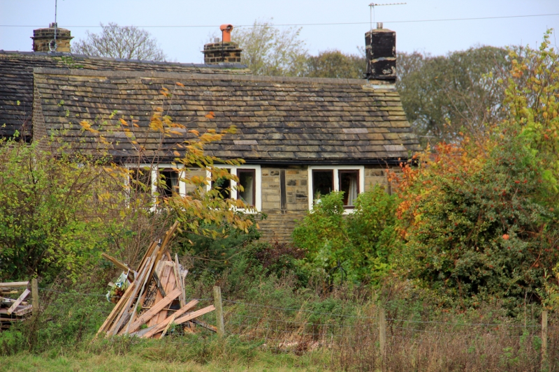
WESTGATE
1.
5113
(South Side)
Almondbury
No 181
SE 1614 45/1383
II
2.
C18 or early C19. Coursed rubble. Pitched stone slate roof. 2 storeys.
One 11-light stone mullioned window (5 lights blocked) on 1st floor, and two
2-light stone mullioned windows on ground floor.
Listing NGR: SE1664214877
External links are from the relevant listing authority and, where applicable, Wikidata. Wikidata IDs may be related buildings as well as this specific building. If you want to add or update a link, you will need to do so by editing the Wikidata entry.


Other nearby listed buildings
