Latitude: 51.5579 / 51°33'28"N
Longitude: -0.0847 / 0°5'4"W
OS Eastings: 532875
OS Northings: 186077
OS Grid: TQ328860
Mapcode National: GBR HC.FBN
Mapcode Global: VHGQT.H33J
Plus Code: 9C3XHW58+54
Entry Name: 1-39, Clissold Road N16
Listing Date: 4 February 1975
Grade: II
Source: Historic England
Source ID: 1226421
English Heritage Legacy ID: 423701
ID on this website: 101226421
Location: Stoke Newington, Hackney, London, N16
County: London
District: Hackney
Electoral Ward/Division: Clissold
Parish: Non Civil Parish
Built-Up Area: Hackney
Traditional County: Middlesex
Lieutenancy Area (Ceremonial County): Greater London
Church of England Parish: St Mary Stoke Newington
Church of England Diocese: London
Tagged with: Building
In the entry for:
CLISSOLD ROAD N16 TQ 3286 1/138 (west side) Nos 1 to 39 (odd)
The map reference should be ammended to read: 11/138
------------------------------------
CLISSOLD ROAD N16 1. 5013 (West Side) ----------------- Nos 1 to 39 (odd) TQ 3286 1/138 II GV
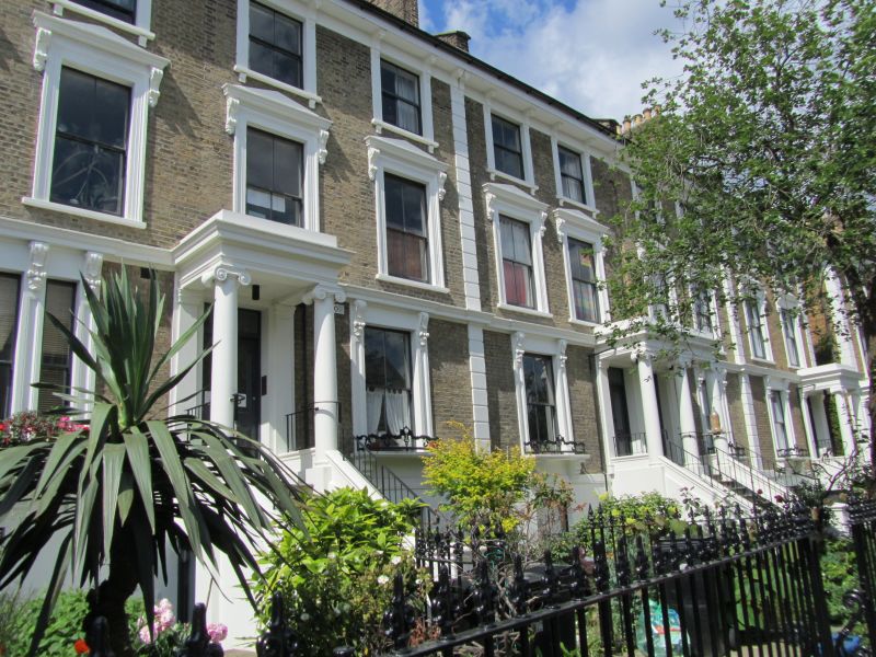
2. Mid C19 composition of blocks of 4 houses, 3 storeys and basement in height. No 1 has 4 windows, the others 2. Yellow brick with axial recesses: and houses divided by stucco quoins. Basement and 1st floor string also stucco. Fairly low pitched hipped slate roof. Sash windows, some with glazing bars, in flat stucco surrounds on and floor, moulded architraves with console bracketed cornices sn st floor, panelled pilasters and console bracketed cornices, continuous with string, on ground floor: also projecting cills with ornamental cast iron guards. O steps to half-glazed 4-panel door, with rectangular fanlight, in prostyle Ionic porch (some porches missing).
Nos 1 to 39 (odd) form a group.
Listing NGR: TQ3287586077
External links are from the relevant listing authority and, where applicable, Wikidata. Wikidata IDs may be related buildings as well as this specific building. If you want to add or update a link, you will need to do so by editing the Wikidata entry.


Other nearby listed buildings