Latitude: 51.5016 / 51°30'5"N
Longitude: -0.1258 / 0°7'32"W
OS Eastings: 530186
OS Northings: 179744
OS Grid: TQ301797
Mapcode National: GBR HH.XW
Mapcode Global: VHGQZ.RJW6
Plus Code: 9C3XGV2F+MM
Entry Name: 44, Parliament Street SW1
Listing Date: 5 February 1970
Grade: II*
Source: Historic England
Source ID: 1226435
English Heritage Legacy ID: 423723
ID on this website: 101226435
Location: Westminster, London, SW1A
County: London
District: City of Westminster
Electoral Ward/Division: St James's
Parish: Non Civil Parish
Built-Up Area: City of Westminster
Traditional County: Middlesex
Lieutenancy Area (Ceremonial County): Greater London
Church of England Parish: St Martin-in-the-Fields
Church of England Diocese: London
Tagged with: Building
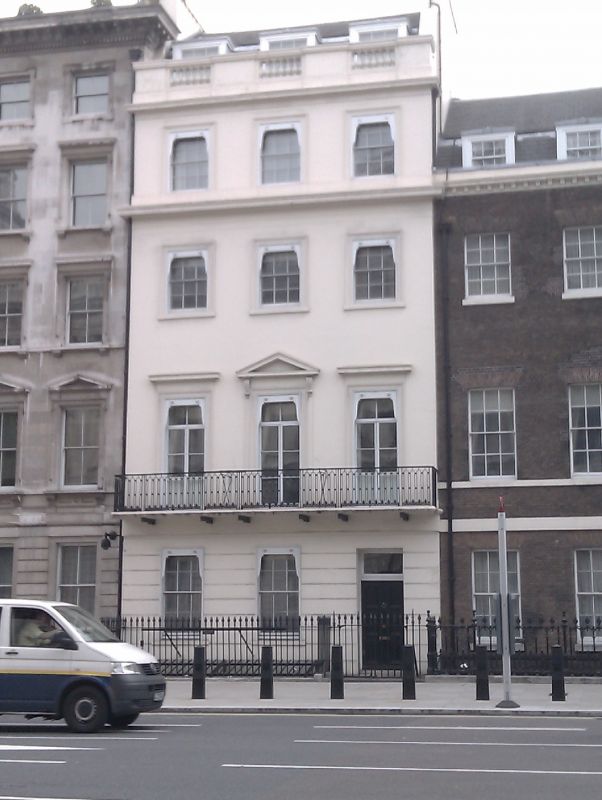
TQ 3079 NW CITY OF WESTMINSTER PARLIAMENT STREET, SW1 92/27 (east side) 5.2.70 No 44 G.V. II* Terraced town house. c1753, altered early C19. Stuccoed brick, slate roof. 4 storeys, basement and dormered mansard. 3 windows wide. Channelled ground floor has c1900 Post Office with pilaster-mullioned window and doorway to right. Upper floors have recessed sashes in stucco architraves, those on 1st floor with cornices, the central window with pediment on consoles. Plat band and sill bands, main cornice over 2nd floor, attic cornice with balustraded parapet. 1st floor has early C19 cast iron balcony. Late C19 cast iron area railings. Interior retains elegant turned baluster staircase and 1st floor drawing room has fine Rococo plasterwork ceiling etc. With No 43 (q.v.) the only surviving terrace house of the original Parliament Street opened in 1749-50. Survey of London; Vol X
Listing NGR: TQ3018679744
External links are from the relevant listing authority and, where applicable, Wikidata. Wikidata IDs may be related buildings as well as this specific building. If you want to add or update a link, you will need to do so by editing the Wikidata entry.


Other nearby listed buildings