Approximate Location Map
Large Map »
Latitude: 52.5154 / 52°30'55"N
Longitude: -1.6669 / 1°40'0"W
OS Eastings: 422701
OS Northings: 290888
OS Grid: SP227908
Mapcode National: GBR 5J9.CCG
Mapcode Global: VHBWH.214J
Plus Code: 9C4WG88M+56
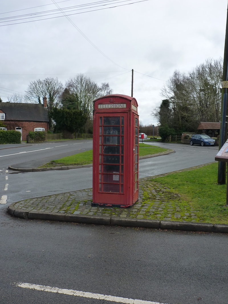
Entry Name: K6 Telephone Kiosk
Listing Date: 9 November 1994
Grade: II
Source: Historic England
Source ID: 1226486
English Heritage Legacy ID: 423806
ID on this website: 101226486
Location: Shustoke, North Warwickshire, B46
County: Warwickshire
District: North Warwickshire
Civil Parish: Shustoke
Traditional County: Warwickshire
Lieutenancy Area (Ceremonial County): Warwickshire
Church of England Parish: Whitacres, Lea Marston and Shustoke
Church of England Diocese: Birmingham
Tagged with: K6 telephone box
The following building shall be added:-
SHUSTOKE
SP2290 THE GREEN
1750-0/12/10000 K6 Telephone Kiosk
GV II
Telephone kiosk, type K6. Designed 1935 by Sir Giles Gilbert Scott. Made by various
contractors. Cast iron. Square kiosk with domed roof. Unperforated crowns to top
panels and margin glazing to windows and door.
Listing NGR: SP2270190888
External links are from the relevant listing authority and, where applicable, Wikidata. Wikidata IDs may be related buildings as well as this specific building. If you want to add or update a link, you will need to do so by editing the Wikidata entry.


Other nearby listed buildings
