Approximate Location Map
Large Map »
Latitude: 51.5267 / 51°31'36"N
Longitude: -0.0879 / 0°5'16"W
OS Eastings: 532739
OS Northings: 182596
OS Grid: TQ327825
Mapcode National: GBR S6.DX
Mapcode Global: VHGQT.FWCJ
Plus Code: 9C3XGWG6+MR
Entry Name: 2 Posts at Junction with City Road
Listing Date: 4 February 1975
Grade: II
Source: Historic England
Source ID: 1226577
English Heritage Legacy ID: 423704
ID on this website: 101226577
Location: Shoreditch, Hackney, London, EC1V
County: London
District: Hackney
Electoral Ward/Division: Hoxton West
Parish: Non Civil Parish
Built-Up Area: Hackney
Traditional County: Middlesex
Lieutenancy Area (Ceremonial County): Greater London
Church of England Parish: St Leonard with S Michael, Shoreditch
Church of England Diocese: London
Tagged with: Building
TQ 3282
34/143
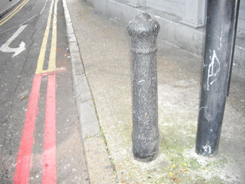
CRANWOOD STREET EC1 (South Side)
Two Posts at junction with City Road
II
Two early-mid C19 cast gunposts, one inscribed on base: "S.L.S Vestry". The other
is sunk too deeply for inscription to be visible.
Listing NGR: TQ3273982596
External links are from the relevant listing authority and, where applicable, Wikidata. Wikidata IDs may be related buildings as well as this specific building. If you want to add or update a link, you will need to do so by editing the Wikidata entry.


Other nearby listed buildings
