Approximate Location Map
Large Map »
Latitude: 51.5482 / 51°32'53"N
Longitude: -0.054 / 0°3'14"W
OS Eastings: 535027
OS Northings: 185051
OS Grid: TQ350850
Mapcode National: GBR J7.31X
Mapcode Global: VHGQV.0BSZ
Plus Code: 9C3XGWXW+79
Entry Name: Wall to North of Former Churchyard of St Augustine
Listing Date: 4 February 1975
Grade: II
Source: Historic England
Source ID: 1226900
English Heritage Legacy ID: 424426
ID on this website: 101226900
Location: Hackney, London, E8
County: London
District: Hackney
Electoral Ward/Division: Hackney Central
Parish: Non Civil Parish
Built-Up Area: Hackney
Traditional County: Middlesex
Lieutenancy Area (Ceremonial County): Greater London
Church of England Parish: St John at Hackney
Church of England Diocese: London
Tagged with: Wall
MARE STREET E8
1.
5013 (East Side)
--------------
Wall to north of
Former Churchyard of
St Augustine
TQ 3585 20/369
II
2.
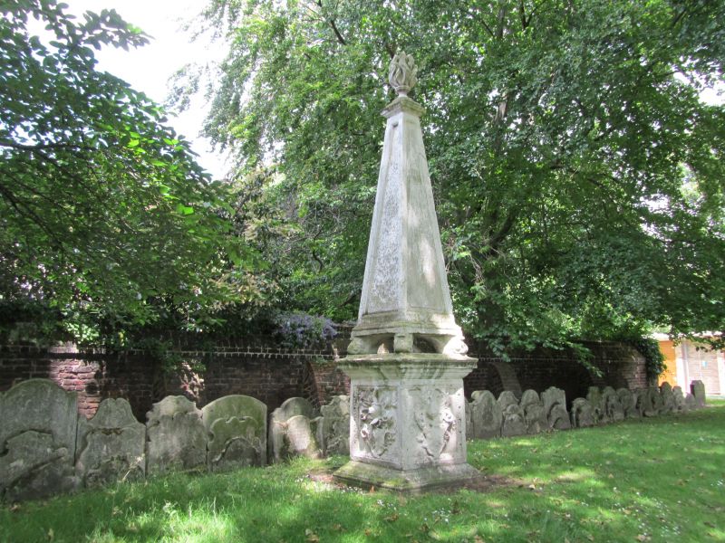
late C17 or early C18 red brick wall. Eastern end has tall, sloped brick coping.
Western end ramped down. Buttresses at intervals. 3 ranks of old tombstones ranged
along the wall a little to the south. At east end the wall returns northwards
for about 10 yds.
Listing NGR: TQ3503085051
External links are from the relevant listing authority and, where applicable, Wikidata. Wikidata IDs may be related buildings as well as this specific building. If you want to add or update a link, you will need to do so by editing the Wikidata entry.


Other nearby listed buildings
