Approximate Location Map
Large Map »
Latitude: 51.5492 / 51°32'56"N
Longitude: -0.0529 / 0°3'10"W
OS Eastings: 535101
OS Northings: 185160
OS Grid: TQ351851
Mapcode National: GBR J7.3BB
Mapcode Global: VHGQV.1BC8
Plus Code: 9C3XGWXW+MR
Entry Name: Beaufort Family Tomb, St John at Hackney Churchyard Gardens
Listing Date: 12 January 2005
Grade: II
Source: Historic England
Source ID: 1391333
English Heritage Legacy ID: 491957
ID on this website: 101391333
Location: St John's Gardens, Lower Clapton, Hackney, London, E5
County: London
District: Hackney
Electoral Ward/Division: Homerton
Parish: Non Civil Parish
Built-Up Area: Hackney
Traditional County: Middlesex
Lieutenancy Area (Ceremonial County): Greater London
Church of England Parish: St John at Hackney
Church of England Diocese: London
Tagged with: Architectural structure
735/0/10167 LOWER CLAPTON ROAD
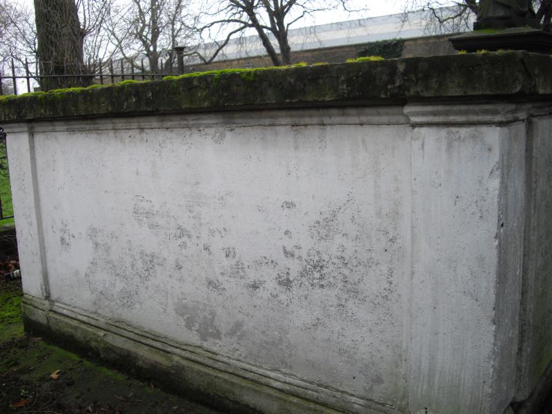
Beaufort Family Tomb, St John at Hackn
ey Churchyard Gardens
GV II
Chest tomb. Portland stone. Chest has square angle pilasters with moulded capitals all on shallow moulded base, re-cut inscription panels and
mid-C20 bronze plaque addressing Rear Admiral Sir Francis Beaufort's importance. Ledger slab on top.
A monument to the Beaufort family. Rear Admiral Sir Francis Beaufort (1774-1856) was Royal Naval Hydrographer from 1829-1855. His Beaufort wind force scale was adopted by the Royal Navy in 1838 and remains widely used as the empirical measure for the intensity of the wind.
A fine mid-C19 chest tomb to the Beaufort family, of historic interest for commemorating Rear Admiral Sir Francis Beaufort, who invented the Beaufort Scale for indicating wind force. It has group value with the Grade II* Church of St. John at Hackney and with other listed monuments in the Churchyard.
External links are from the relevant listing authority and, where applicable, Wikidata. Wikidata IDs may be related buildings as well as this specific building. If you want to add or update a link, you will need to do so by editing the Wikidata entry.


Other nearby listed buildings
