Approximate Location Map
Large Map »
Latitude: 50.7313 / 50°43'52"N
Longitude: -2.7577 / 2°45'27"W
OS Eastings: 346619
OS Northings: 92679
OS Grid: SY466926
Mapcode National: GBR PP.0K5N
Mapcode Global: FRA 5734.X1C
Plus Code: 9C2VP6JR+GW
Entry Name: 53-61, South Street
Listing Date: 19 September 1975
Grade: II
Source: Historic England
Source ID: 1227860
English Heritage Legacy ID: 402346
ID on this website: 101227860
Location: New Zealand, Dorset, DT6
County: Dorset
Civil Parish: Bridport
Built-Up Area: Bridport
Traditional County: Dorset
Lieutenancy Area (Ceremonial County): Dorset
Church of England Parish: Bridport St Mary
Church of England Diocese: Salisbury
Tagged with: Building
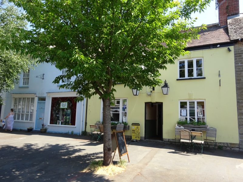
1.
5191
SOUTH STREET
(East Side)
Nos 53 to 6l (odd)
SY 4692 1/122
II GV
2.
Mainly early C19. Stucco. Slate and tile roofs. 2 storeys. Mostly sashes
with glazing bars. 2 round-headed doorways. 3 small contemporary shop windows,
2 with glazing bars.
Nos 53 to 81 (odd) form a group.
Listing NGR: SY4662892669
External links are from the relevant listing authority and, where applicable, Wikidata. Wikidata IDs may be related buildings as well as this specific building. If you want to add or update a link, you will need to do so by editing the Wikidata entry.


Other nearby listed buildings
