Approximate Location Map
Large Map »
Latitude: 50.7313 / 50°43'52"N
Longitude: -2.7582 / 2°45'29"W
OS Eastings: 346588
OS Northings: 92680
OS Grid: SY465926
Mapcode National: GBR PP.0K18
Mapcode Global: FRA 5734.WTW
Plus Code: 9C2VP6JR+GP
Entry Name: 68 and 70, South Street
Listing Date: 19 September 1975
Grade: II
Source: Historic England
Source ID: 1287252
English Heritage Legacy ID: 402929
ID on this website: 101287252
Location: New Zealand, Dorset, DT6
County: Dorset
Civil Parish: Bridport
Built-Up Area: Bridport
Traditional County: Dorset
Lieutenancy Area (Ceremonial County): Dorset
Church of England Parish: Bridport St Mary
Church of England Diocese: Salisbury
Tagged with: Building
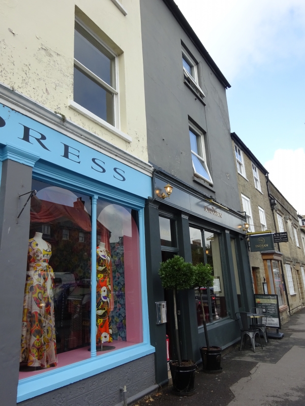
1.
5191 SOUTH STREET
(West Side)
Nos 68 & 70
SY 4692 1/103
II GV
2.
Early C19. Stucco. 3 storeys. 3 ranges of sashes. Shop front with pilasters
and oblong fanlights, 3-centred arch with keystone at south end of front.
Nos 64 to 80 (even) and No 80A form a group.
Listing NGR: SY4658492684
External links are from the relevant listing authority and, where applicable, Wikidata. Wikidata IDs may be related buildings as well as this specific building. If you want to add or update a link, you will need to do so by editing the Wikidata entry.


Other nearby listed buildings
