Latitude: 50.7311 / 50°43'51"N
Longitude: -2.7577 / 2°45'27"W
OS Eastings: 346620
OS Northings: 92659
OS Grid: SY466926
Mapcode National: GBR PP.0K5Q
Mapcode Global: FRA 5734.X1G
Plus Code: 9C2VP6JR+CW
Entry Name: 63 and 65, South Street
Listing Date: 19 September 1975
Grade: II
Source: Historic England
Source ID: 1287459
English Heritage Legacy ID: 402347
ID on this website: 101287459
Location: New Zealand, Dorset, DT6
County: Dorset
Civil Parish: Bridport
Built-Up Area: Bridport
Traditional County: Dorset
Lieutenancy Area (Ceremonial County): Dorset
Church of England Parish: Bridport St Mary
Church of England Diocese: Salisbury
Tagged with: Building
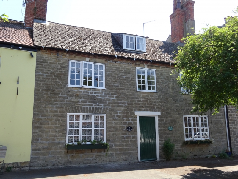
1.
5191 SOUTH STREET
(East Side)
Nos 63 & 65
SY 4692 1/123
II GV
2.
C18 or C19. Hammer dressed stone. Old slate roof. Brick modillion eaves
cornice. 2 storeys, and attics. 3 ranges of casements with gauged stone voussoirs.
Attic dormer. Central passage entrance to houses.
Nos 53 to 81 (odd) form a group.
Listing NGR: SY4662392661
External links are from the relevant listing authority and, where applicable, Wikidata. Wikidata IDs may be related buildings as well as this specific building. If you want to add or update a link, you will need to do so by editing the Wikidata entry.


Other nearby listed buildings