Latitude: 53.5003 / 53°30'1"N
Longitude: -2.3808 / 2°22'50"W
OS Eastings: 374835
OS Northings: 400468
OS Grid: SD748004
Mapcode National: GBR CWTY.CY
Mapcode Global: WH988.D8HY
Plus Code: 9C5VGJ29+4M
Entry Name: 3, Worsley Road
Listing Date: 2 September 1987
Grade: II
Source: Historic England
Source ID: 1227929
English Heritage Legacy ID: 400057
Also known as: The Nailmaker's House, Worsley
ID on this website: 101227929
Location: Worsley, Salford, Greater Manchester, M28
County: Salford
Electoral Ward/Division: Worsley
Parish: Non Civil Parish
Built-Up Area: Eccles
Traditional County: Lancashire
Lieutenancy Area (Ceremonial County): Greater Manchester
Church of England Parish: Worsley St Mark
Church of England Diocese: Manchester
WORSLEY WORSLEY ROAD SD 70 SW (south side) 1/66 No.3 - G.V. II
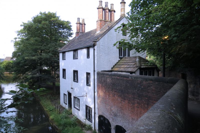
House and shop. Early C18. Rendered stone with graduated stone slate roof and stone dressings. 3 x 2 bays with 3 storeys. Door between bays 1 and 2 flanked by 2 and 3-light casement windows. All the other windows i.e. one more on the ground floor and 3 on the first and second have 1, 2 or 3 lights and chamfered stone mullions (double-chamfered in some cases). Coped gables with kneelers and finial. Ridge and gable chimney stacks with diagonally set shafts. 2 chamfered door surrounds and 6-panel doors at first floor level in right gable-end and a small addition with hipped roof. Similar windows to sides and rear. 1807 line drawing in F. Mullineux The Duke of Bridgewater's Canal, 1959. The building has been used variously in the past as a nail-maker's shop, a library, a reading room and a house.
Listing NGR: SD7483500468
External links are from the relevant listing authority and, where applicable, Wikidata. Wikidata IDs may be related buildings as well as this specific building. If you want to add or update a link, you will need to do so by editing the Wikidata entry.


Other nearby listed buildings