Approximate Location Map
Large Map »
Latitude: 50.7039 / 50°42'14"N
Longitude: -3.2115 / 3°12'41"W
OS Eastings: 314545
OS Northings: 90061
OS Grid: SY145900
Mapcode National: GBR P9.G8C5
Mapcode Global: FRA 4756.STF
Plus Code: 9C2RPQ3Q+HC
Entry Name: Boswell Farmhouse
Listing Date: 12 October 1951
Grade: II
Source: Historic England
Source ID: 1228395
English Heritage Legacy ID: 402827
ID on this website: 101228395
Location: East Devon, EX10
County: Devon
District: East Devon
Civil Parish: Sidmouth
Built-Up Area: Sidmouth
Traditional County: Devon
Lieutenancy Area (Ceremonial County): Devon
Church of England Parish: Sidbury with Sidford
Church of England Diocese: Exeter
Tagged with: Farmhouse Thatched farmhouse
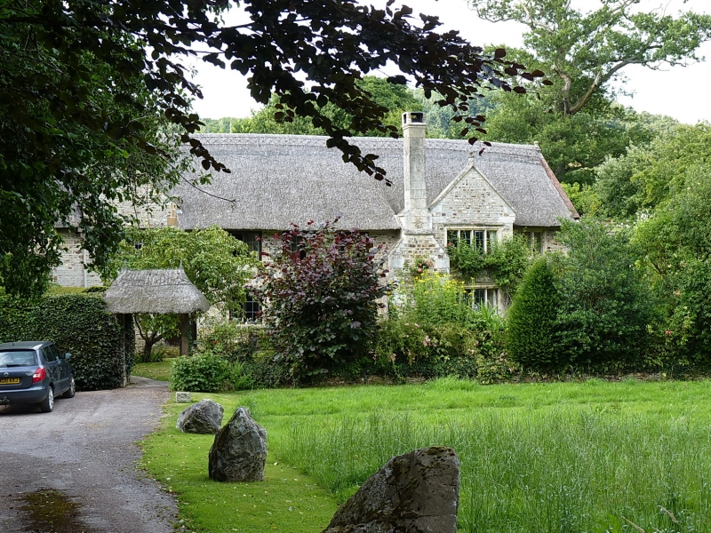
UNDER LANE, HARCOMBE
1.
1633
Boswell Farmhouse
SY 19 SW 12/151 12.10.51.
II
2.
C17 two storey stone rubble. Thatched roof. Gable and external stone
chimney on front. 6 mullioned windows. The west end probably a later
addition. C18 doorcase. Part of hamlet in Sidbury Parish to north east
of Sidmouth. Reached by track to south of lane.
Listing NGR: SY1454590061
External links are from the relevant listing authority and, where applicable, Wikidata. Wikidata IDs may be related buildings as well as this specific building. If you want to add or update a link, you will need to do so by editing the Wikidata entry.


Other nearby listed buildings
