Approximate Location Map
Large Map »
Latitude: 53.5615 / 53°33'41"N
Longitude: -2.6951 / 2°41'42"W
OS Eastings: 354053
OS Northings: 407433
OS Grid: SD540074
Mapcode National: GBR 9WM8.91
Mapcode Global: WH86L.KRT1
Plus Code: 9C5VH863+HX
Entry Name: Gathurst Bridge
Listing Date: 10 May 1988
Grade: II
Source: Historic England
Source ID: 1228454
English Heritage Legacy ID: 403046
ID on this website: 101228454
Location: Gathurst, Wigan, Greater Manchester, WN6
County: Wigan
Civil Parish: Shevington
Traditional County: Lancashire
Lieutenancy Area (Ceremonial County): Greater Manchester
Church of England Parish: Shevington St Anne
Church of England Diocese: Blackburn
Tagged with: Bridge
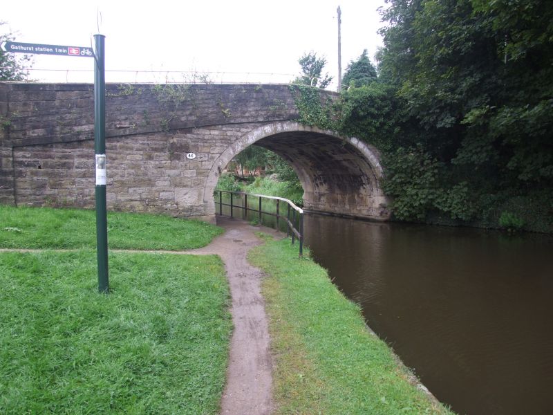
SHEVINGTON GATHURST LANE
SD 50 NW
4/109 Gathurst Bridge
-
- II
Bridge over Leeds and Liverpool Canal. 1780s. Stone.
Elliptical arch with cambered band and parapet over; end
piers.
Listing NGR: SD5405307433
External links are from the relevant listing authority and, where applicable, Wikidata. Wikidata IDs may be related buildings as well as this specific building. If you want to add or update a link, you will need to do so by editing the Wikidata entry.


Other nearby listed buildings
