Latitude: 53.0842 / 53°5'3"N
Longitude: -2.8774 / 2°52'38"W
OS Eastings: 341326
OS Northings: 354472
OS Grid: SJ413544
Mapcode National: GBR 7B.9PK6
Mapcode Global: WH88T.RQZX
Plus Code: 9C5V34MF+M2
Entry Name: Pair of Adjacent Table Tombs in Churchyard (South of St Chad's Church, East of Path to Church Porch)
Listing Date: 28 November 1984
Grade: II
Source: Historic England
Source ID: 1228746
English Heritage Legacy ID: 403427
ID on this website: 101228746
Location: St Chad's Church, Farndon, Cheshire West and Chester, Cheshire, CH3
County: Cheshire West and Chester
Civil Parish: Farndon
Built-Up Area: Farndon (Cheshire West and Chester)
Traditional County: Cheshire
Lieutenancy Area (Ceremonial County): Cheshire
Church of England Parish: Farndon St Chad
Church of England Diocese: Chester
Tagged with: Table tomb Table tomb
SJ 45 SW FARNDON C.P. CHURCH ROAD
2/29 Pair of adjacent Table Tombs in Churchyard (south of St Chad's Church, east of path to Church Porch).
-
- II
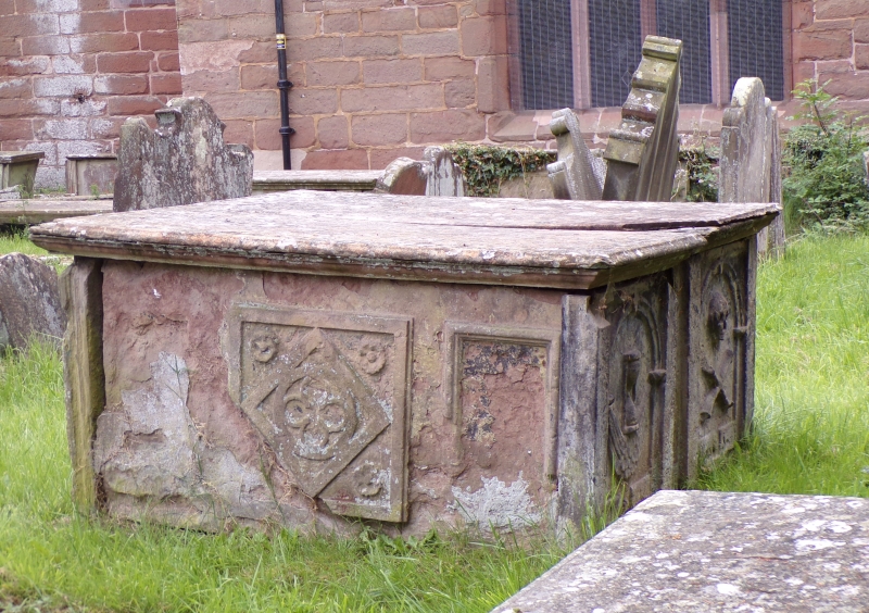
Pair of adjacent table tombs, early C18, of yellow sandstone. The inscriptions are badly weathered; that on north tomb includes 1726 as a date of death. West ends of tombs have recessed round-headed panels; that to north contains an hourglass, that to south a skull and crossbones above an inscription Mors S... Omnium. North side of north tomb has a square central panel containing an encircled quatrefoil in a lozenge with a vertical panel right and a decayed panel left. The east end of each tomb has a fielded panel; south side of south tomb has 3 fielded panels in bolection moulded borders.
Listing NGR: SJ4132654472
External links are from the relevant listing authority and, where applicable, Wikidata. Wikidata IDs may be related buildings as well as this specific building. If you want to add or update a link, you will need to do so by editing the Wikidata entry.


Other nearby listed buildings