Latitude: 52.9295 / 52°55'46"N
Longitude: -1.4782 / 1°28'41"W
OS Eastings: 435174
OS Northings: 337030
OS Grid: SK351370
Mapcode National: GBR PKC.26
Mapcode Global: WHDGT.8MCJ
Plus Code: 9C4WWGHC+RP
Entry Name: St Alkmunds Well
Listing Date: 20 June 1952
Grade: II
Source: Historic England
Source ID: 1230158
English Heritage Legacy ID: 404728
ID on this website: 101230158
Location: Little Chester, Derby, Derbyshire, DE1
County: City of Derby
Electoral Ward/Division: Darley
Parish: Non Civil Parish
Built-Up Area: Derby
Traditional County: Derbyshire
Lieutenancy Area (Ceremonial County): Derbyshire
Church of England Parish: Derby St Alkmund and St Werburgh
Church of England Diocese: Derby
Tagged with: Well
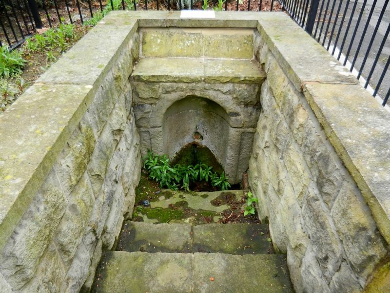
WELL STREET 1. 5170 St Alkmund's Well SK 33 NE 9/316 20.6.52. II
2. Medieval origin. Small stone contains jet of water, set below street level at junction with Bath Street. Approached down 3 stone steps. Low stone wall on right-hand side now added with iron railings around 3 sides.
Listing NGR: SK3517437030
External links are from the relevant listing authority and, where applicable, Wikidata. Wikidata IDs may be related buildings as well as this specific building. If you want to add or update a link, you will need to do so by editing the Wikidata entry.


Other nearby listed buildings