Latitude: 52.4638 / 52°27'49"N
Longitude: -2.2043 / 2°12'15"W
OS Eastings: 386218
OS Northings: 285116
OS Grid: SO862851
Mapcode National: GBR 1BW.FK5
Mapcode Global: VH91G.RB1L
Plus Code: 9C4VFQ7W+G7
Entry Name: Stourbridge Canal Pair of Locks at Junction with Staffordshire and Worceshire Canal
Listing Date: 18 December 1987
Grade: II
Source: Historic England
Source ID: 1232007
English Heritage Legacy ID: 407318
ID on this website: 101232007
Location: Stourton, South Staffordshire, DY7
County: Staffordshire
District: South Staffordshire
Civil Parish: Kinver
Built-Up Area: Stourton
Traditional County: Staffordshire
Lieutenancy Area (Ceremonial County): Staffordshire
Church of England Parish: Kinver St Peter
Church of England Diocese: Lichfield
Tagged with: Lock
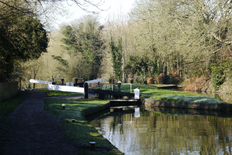
KINVER C.P. STOURBRIDGE CANAL
SO 88 NE
9/100 Pair of locks at junction
with Staffordshire and
Worcestershire Canal
II
Pair of canal locks. Late C18 with later repairs. Brick with stone coping.
The Stourbridge canal opened through the area in 1779 to join the
Staffordshire and Worcestershire canal near Stewponey Wharf.
Listing NGR: SO8621885116
External links are from the relevant listing authority and, where applicable, Wikidata. Wikidata IDs may be related buildings as well as this specific building. If you want to add or update a link, you will need to do so by editing the Wikidata entry.


Other nearby listed buildings