Approximate Location Map
Large Map »
Latitude: 51.1386 / 51°8'18"N
Longitude: 0.9707 / 0°58'14"E
OS Eastings: 607911
OS Northings: 141897
OS Grid: TR079418
Mapcode National: GBR SYC.D8L
Mapcode Global: VHKKP.SN01
Plus Code: 9F324XQC+C7
Entry Name: Fordswater
Listing Date: 16 February 1989
Grade: II
Source: Historic England
Source ID: 1232941
English Heritage Legacy ID: 408307
ID on this website: 101232941
Location: Bircholt Forstal, Ashford, Kent, TN25
County: Kent
District: Ashford
Civil Parish: Brabourne
Traditional County: Kent
Lieutenancy Area (Ceremonial County): Kent
Tagged with: Building
TR 04 SE BRABOURNE WEST BRABOURNE
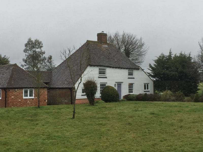
4/42 Fordswater
II
House. C16, clad late C18. Timber framed and roughcast with plain
tiled roof. Two storeys and hipped roof with gablets and with central
stack. Catslide outshots to left and to right. Two glazing bar sashes
on each floor and central panelled door.
Listing NGR: TR0791141897
External links are from the relevant listing authority and, where applicable, Wikidata. Wikidata IDs may be related buildings as well as this specific building. If you want to add or update a link, you will need to do so by editing the Wikidata entry.


Other nearby listed buildings
